The likelihood of extreme precipitation grew 7% over the 20th century. According to a report published in the journal Nature today the 7% increase was not caused by natural variability.
The principal finding of the new study i s “that this 7 percent is well outside the bounds of natural variability,” said Francis W. Zwiers, a Canadian climate scientist who took part in the research.
One likely contributor to the increase in extreme precipitation, especially in temperate climates, is that atmospheric rivers are moving further north as the earth warms. The pineapple express is a well known "river in the sky" that moves Hawaiian moisture towards Seattle. Similar atmospheric rivers have apparently extended further north than normal, bringing higher floods to the north temperate zone.
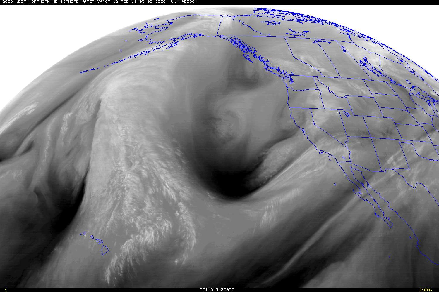
NOAA water vapor imagery shows atmospheric rivers that caused extreme precipitation events.

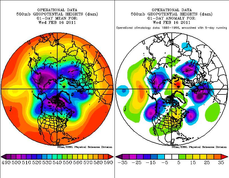
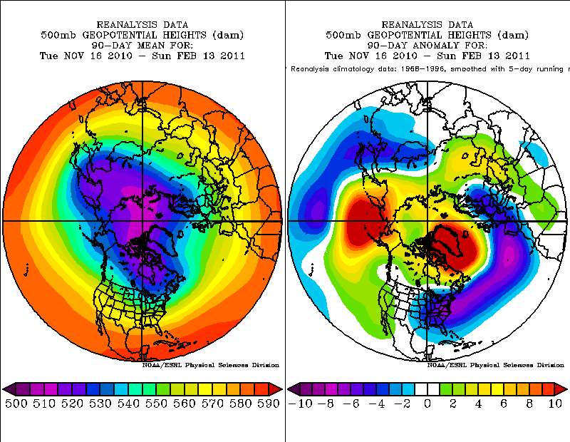
As the Arctic warmed rapidly over the twentieth century, the tight ring of strong winds around the pole retreated poleward and weakened.

Since 1975 the average temperature of the earth has risen almost 1 degree F.
The average global temperature has increased by about 0.8°Celsius (1.4° Fahrenheit) since 1880. Two-thirds of the warming has occurred since 1975.
Today, for example, the polar jet stream has retreated poleward over the north Pacific.
The poleward shift of the polar jet stream allows tropical moisture to be transported further north than normal. Today's satellite images show an atmospheric river flowing from the tropics south of Hawaii, over Alaska, all the way into the Arctic.

Warm air has penetrated far further north over the north Pacific and north Atlantic oceans all winter this year and last year. The weakening of the polar circulation has increased the north south transport of moisture, while bringing cold air to the north eastern U.S. and north eastern China while transporting much warmer than normal air into the Arctic.
Besides increasing the number of extreme precipitation events north of 45 degrees north, the transport of more water vapor towards the north pole may be slowing the winter build up of Arctic sea ice. A study just published shows that clouds act as a blanket keeping heat from radiating to space over the Arctic ocean. If winter cloudiness increases, the growth of sea ice each winter will decline.
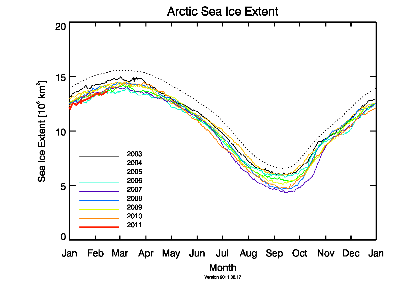 Figure source
The reduction in sea ice may intensify a feedback loop by releasing more heat to the Arctic. Arctic heating increases the weakening of the polar circulation system and speeds up the loss of sea ice.
This will likely lead to extreme flooding events north of 45 degrees N happening more frequently.
