I was wondering.... is there a way to get the GOP what they are looking for (essentially, protecting Duffy) with a map that does not appear so gerrymandered. Here is my take on this:
A closer look at each district:
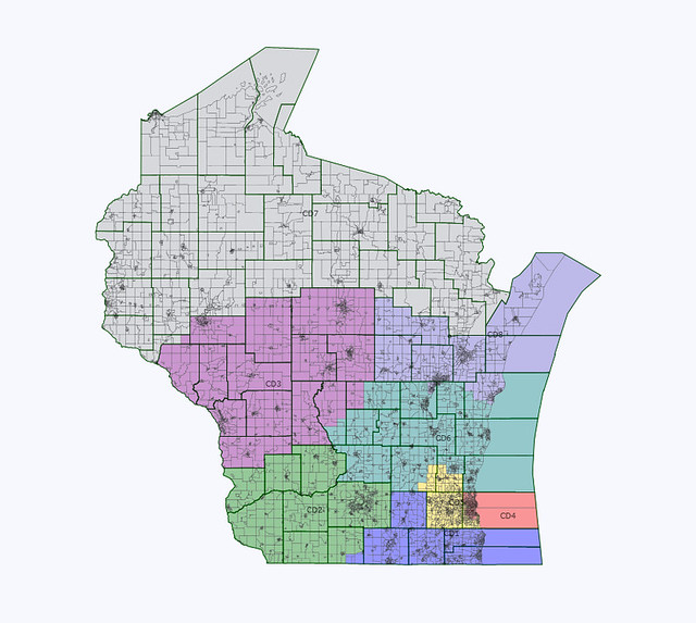
CD-1 (Ryan):
This district would be a very much 50/50 district. 55.5% Obama in 2008, but 45.0% Dem in 2010. Ryan will be questionable no matter what due to his recent political stances. This district is probably not as good for him as the one drawn in the GOP proposal.
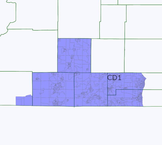
CD-2 (Baldwin):
This is a solid Democratic district, at 69.8% Obama in 2008 and 64.5% Dem in 2010. District includes Dane County as a base, but extends into the Southwest corner of the state. Probably any Democrat to follow Baldwin should she run for Senate would win the new 2nd.
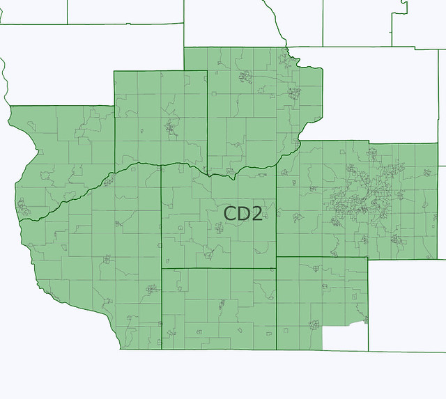
CD-3 (Kind):
This is a likely Democratic district, especially with Kind running. The district changes significantly, becoming a west-central to central district. Essentially, the central cities (Wausau, Stevens Point, Marshfield, Wisconsin Rapids), and the western cities (Eau Claire, LaCrosse). 57.9% Obama in 2008, 46.9% Dem in 2010.
CD-4 (Moore):
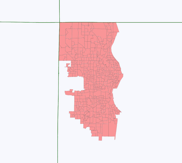
Solid Democratic district. Most of the old district, with the addition of all the northern Milwaukee County suburbs. 74.2% Obama, 70.0% Dem in 2010. VAP = 51.1% white, 30.5% black, 13.1% Hispanic, 3.3% Asian, 0.6% native. Based on actual population, it would be a white plurality district.
CD-5 (Sensenbrenner):
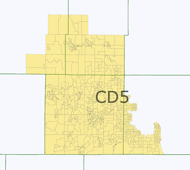
Solid Republican district. Waukesha Co. focused, with parts of surrounding counties. 40.2% Obama, 32.1% Dem in 2010.
CD-6 (Petri):
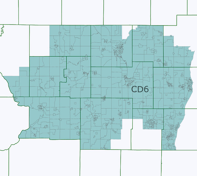
Likely Republican district. 47.0% Obama, 36.3% Dem in 2010. Probably the weirdest-shaped district of all 8. Generally, same territory as old 6th district.
CD-7 (Duffy):
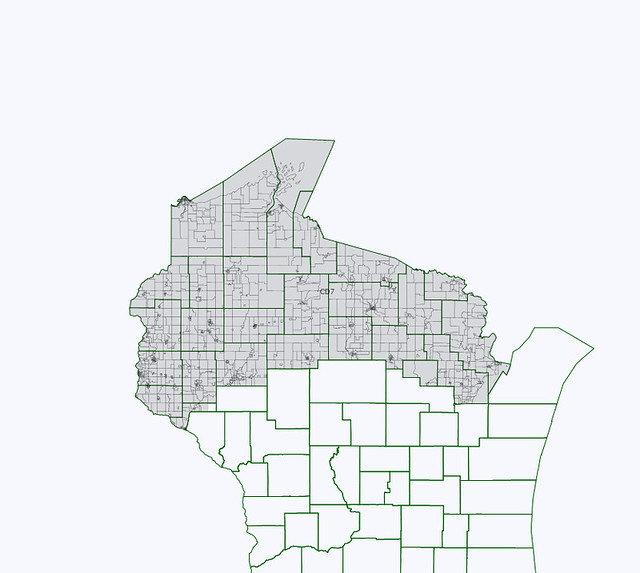
Likely Republican. Now, instead of a northwest and central district, this district covers the entire area of Wisconsin considered the Northwoods. 53.6% Obama, 44.2% Dem in 2010.
CD-8 (Ribble):
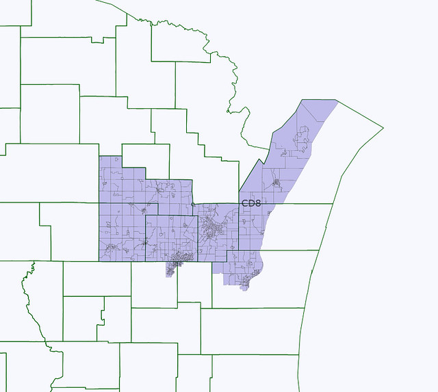
Likely Republican. Appleton, Green Bay, Manitowoc, and rural areas. 54.3% Obama, 43.5% Dem in 2010.
