I am working on some potential, more Democratic-friendly, congressional maps for states that don't seem to be making the news. Now some of these states are so Republican heavy, districts like this will never happen. However, they would be possible. This is a first in a series.
First state, Idaho:
As shown in 2008, a Democrat can win a congressional election in Idaho. Unfortunately, Democrats can lose two years later. Here is my map that makes that one of Idaho's two congressional districts a bit more friendly for a Democrat (CD-1 in blue, CD-2 in green):
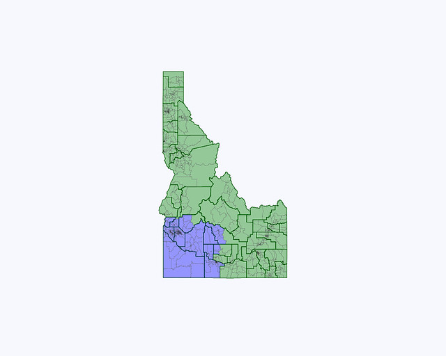
Proposed New Congressional Map:
Current Congressional Map:
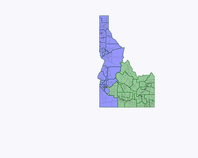
Old CD-1: In 2008, 36.7% Obama, 63.3% McCain (but elected a Democrat to Congress)
New CD-1: In 2008, 40.9% Obama, 59.1% McCain
Old CD-2: In 2008, 37.3% Obama, 62.7% McCain
New CD-2: In 2008, 33.2% Obama, 66.8% McCain
CD-1 needed to lose population, as it has 116,270 more people than CD-2. Currently, the Boise area is split between the two districts. My plan places CD-1 in the SW corner of the state, while CD-2 covers everything else.
The two incumbents would reside in their respective districts. A Republican is a shoe-in in CD-2, but in CD-1, the seat could change hands more frequently between Democrats and Republicans.
Interestingly, these districts are VERY close in population now. 783,790 in CD-1 and 783,792 in CD-2. About as close as you can get.
