Tips for using our government weather websites
The Daily Bucket is a place where we post and exchange our observations about what is happening in the natural world in our neighborhood. Birds, blooms, bugs - each note is a record that we can refer to in the future as we try to understand the patterns that are quietly unwinding around us.
August 21, 2012 and hurricane season is only starting
I don't suppose living along the Gulf Coast and watching the weather is much different here than other places. We get hurricanes and floods and big rains and wind. Substitute tornados or nor'easters or cyclones or merciless heat or cold for where you live. If you want to know how all those things work - see the DK weatherdude. The series on explaining the weather buzzword of the summer, derechos, is great.
There was also a group doing a severe weather blog or you can follow the weather tag for lots of diaries that may or may not concern you.
What I present today is step by step how I get thru a summer season along the Gulf while showing how to use our government websites.
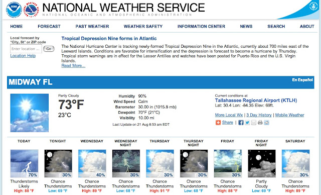
Local forecast is the first bookmark I use in the morning - mine is set to Tallahassee FL. Use the box for "Local forecast by City, St or ZIP code" to find yours.
This site was redesigned earlier this summer and works much better. One addition is the general news posted above the current conditions and 5 day forecast.
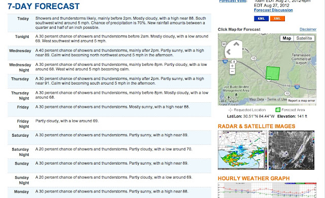
There is a lot at this page. Scrolling down you get the text version of a 7 day forecast.
Finetune location with map. Bookmark it and you have your latitude and longitude set.
Use the graphic link to a big satellite image of US or click on local radar.
My radar comes up for Tallahassee but since storms typically come from west, I use the Adjacent Radars arrows to go 1 station west. This is what I have bookmarked.
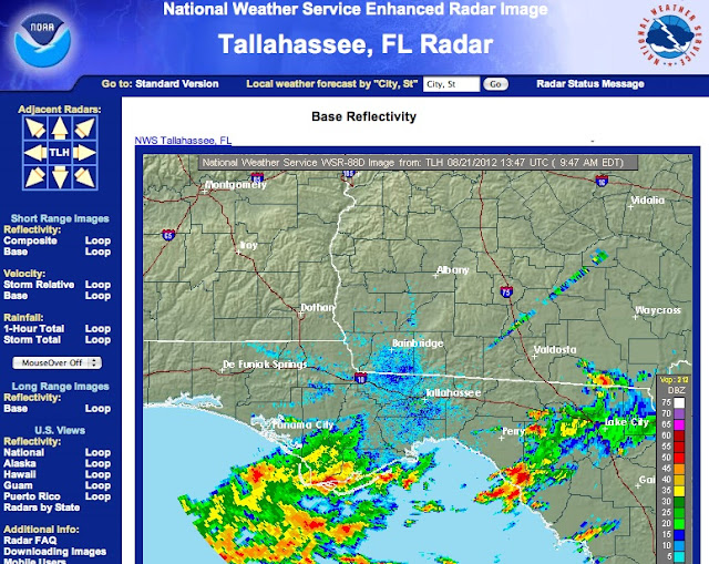
I prefer the default - Short Range Base Reflectivity. Check out the other options like looping which then allows you to click down to a specific area. On my home computer I can set the loop; this does not work on iPad. This page can be set to auto-update (every 7-8 minutes) - options are at bottom of radar screen
Note the small graphics below - National Radar Mosaic Sectors or enhanced radar as I call it. Each composite gives you a bigger picture of approaching storms. I have the Southeast bookmarked as I go here often.
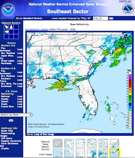
To put it into loop mode, click link below graphic. To see the whole country, link is above. Looks great on a 21" monitor. Clicking anywhere within the graphic will take you to local radar. Be advised that radar does not extend far beyond the Us borders.
Hurricanes
This is National Hurricane Center home
but I go right to here to see the Tropical Outlook
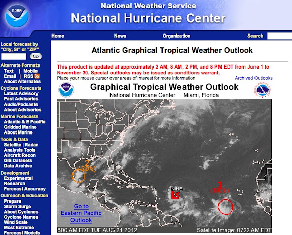
Lots to see on this page and links to follow. What I do is click on image of the Tropics and go to another page where you can hover over each potential storm to read details. Clicking on TD#9 (soon to be Issac) brings up the 5 day tracking for that tropical storm. Very handy....
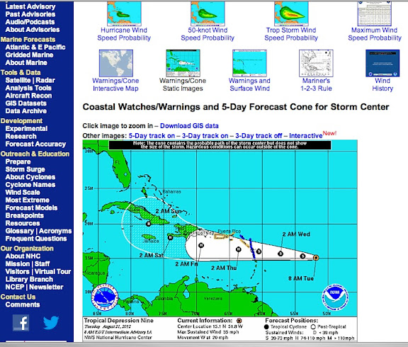
Click image to go to bigger version. Advisories are updated every few hours.
Another option is to go to NOAA tropical websitewhich gives similar information in different format. Here you click the map pins to go to bulletin or images.
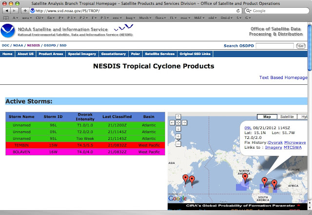
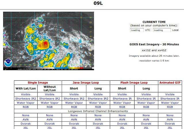
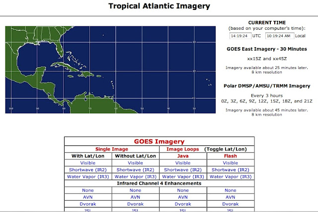
The typical storm image is a GOES floater, a satellite aimed directly at storm. Note the matrix of image options.
I like to get a bigger picture so I found this site once and bookmarked it.
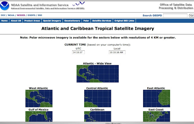
Today I choose the whole wide Atlantic view
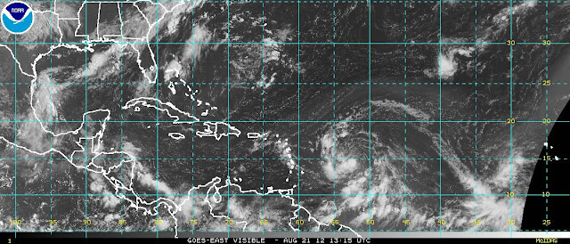
and then went for the "visible" image. Black areas on the map mean the sun has set there.
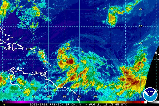
Here's the Central Atlantic Imagery with infrared rainbow
So this is how I use our government websites. Try playing around with them and find out what works best for you. Please comment anytime you are asked or see a link and tell our goverment what a great job we do!
Still a rainy day here in Tallahassee but this diary has filled in the morning quite well. How's everything out there in the rest of the world? Any interesting weather?

