The Daily Bucket is a place where we post and exchange our observations about the natural happenings we see. Birds, blooms, bugs and more - each note is a record that we can refer to in the future as we try to understand the patterns that are quietly unwinding around us.
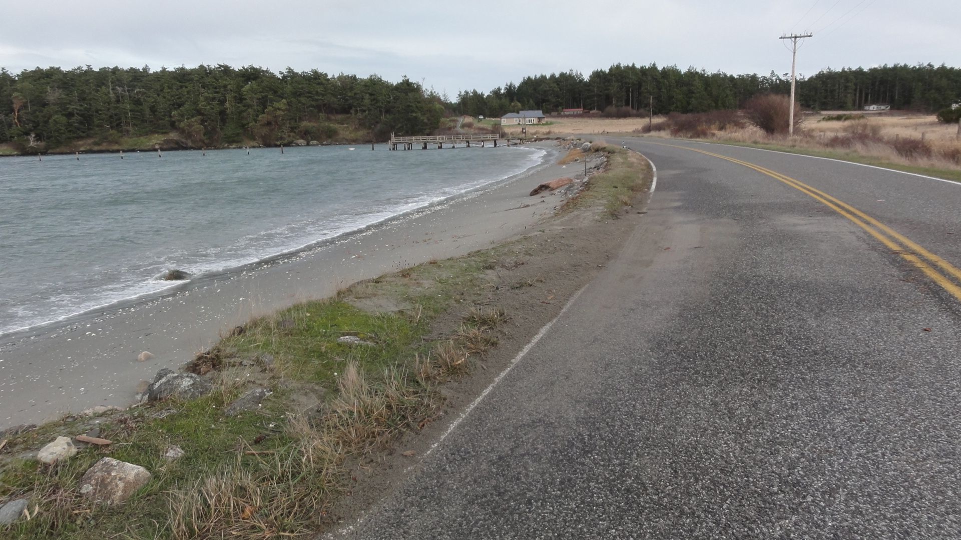
December 17, 2012. Agate Beach on Outer Bay, Lopez. In the distance are San Juan Island and Vancouver Island.
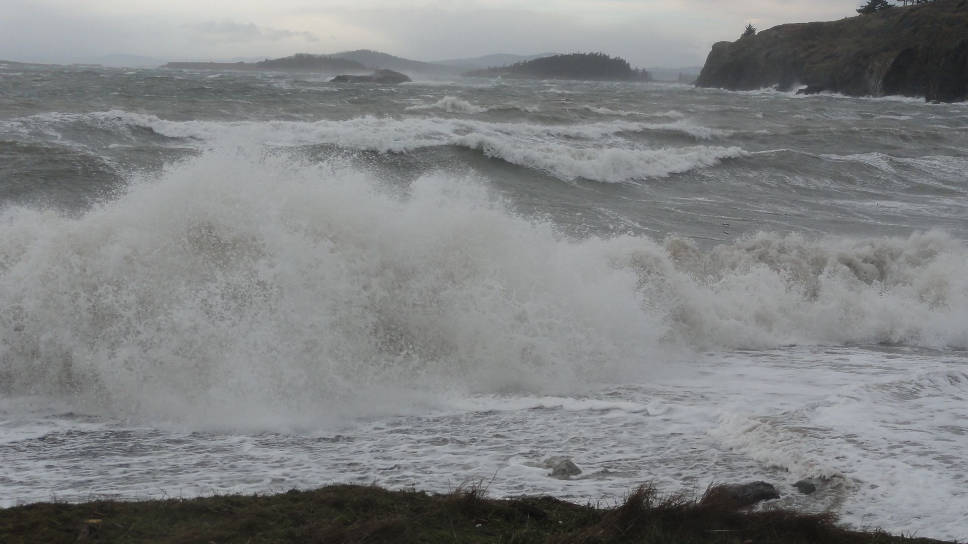
Winter is wild weather season in the Pacific Northwest, and so long as you're not out in a boat, or your power goes out, it's great drama, especially on the beach. Last night we had a moderately big storm come ashore along the Washington coast.
Typically, winter storms come in from the ocean with the prevailing westerlies, and that's what this one did. Along the leading edge of the system last night we had 30-40 knot southeasterly winds and then in the middle of the night (exactly as the NWS predicted - yes, weather predictors get it right more often than they get credit for!) the wind switched as the center of the low passed over us. Since then, we've had strong westerly wind (25-40 knots) all day. One source of information we use to track our weather is the NOAA National Data Buoy Center http://www.ndbc.noaa.gov/...
Here we track not just the wind and the height of the wave swells, but also the air pressure. The faster the pressure drops the stronger a storm it is, and since wind blows toward the center of low pressure, we know where that center must be relative to us. The wind data is also better at buoys than on land, where topography affects it.
I went out this morning to catch the action, and even though it was several hours past the high tide, there were waves breaking on the west-facing Agate Beach, which is at the south end of the island.
Sorry it's a bit fuzzy - that's salt spray on my camera lens!
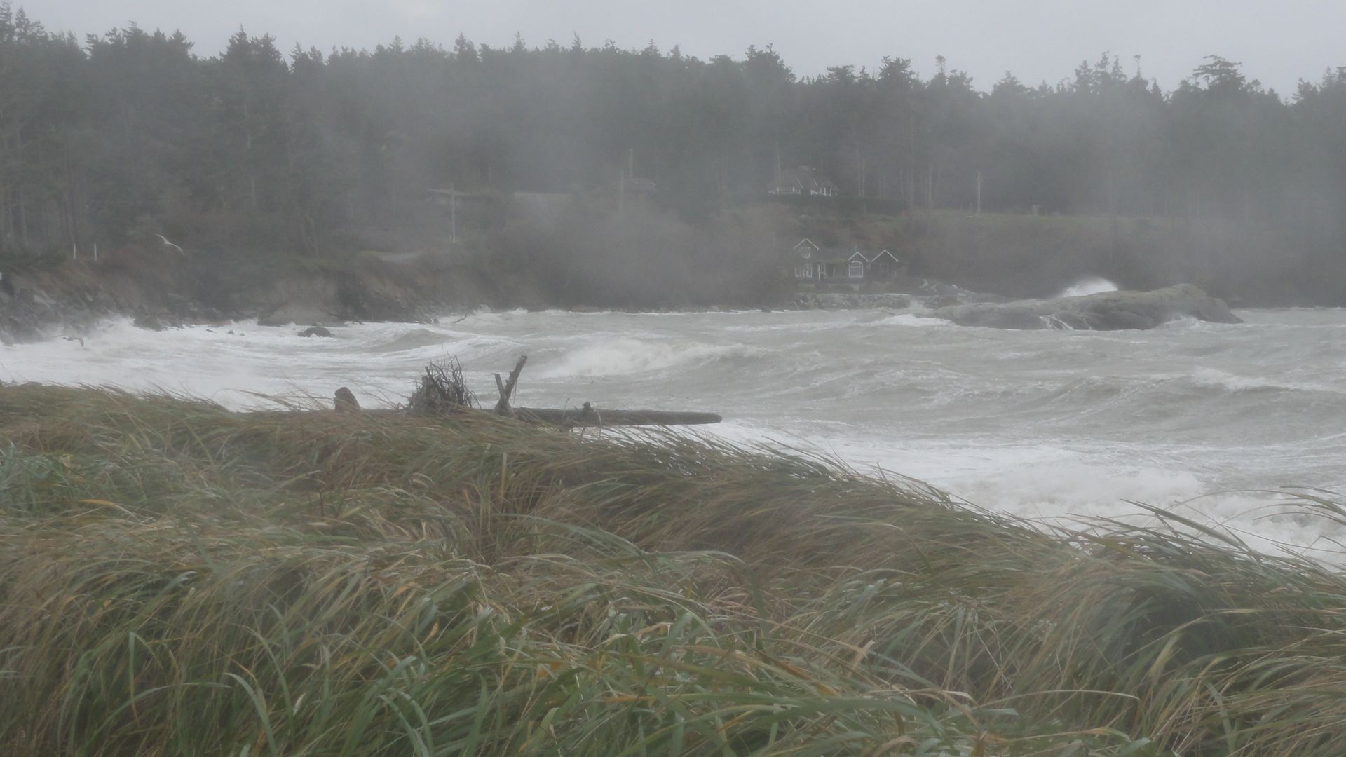
We're looking south down the beach from here. Notice the grass is bent over in the wind.
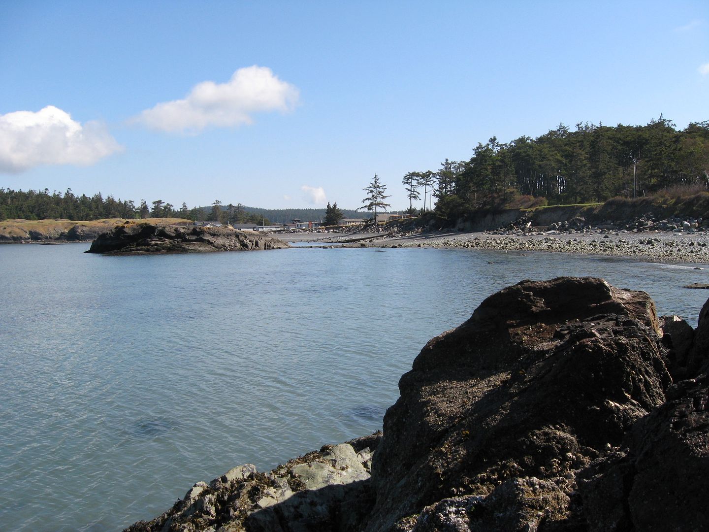
Usually, our waters are pretty flat since we are so far from the open ocean. Here's a typical view of Agate Beach most days, from the other direction. The little island in the middle of the bay is the same one in the photo above on the right, with waves breaking over it.
For some context, from a USGS map:
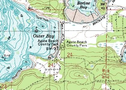
We have a small County day park on part of this beach. About 10 years ago, a new stairway was built to get down to the beach from the road.
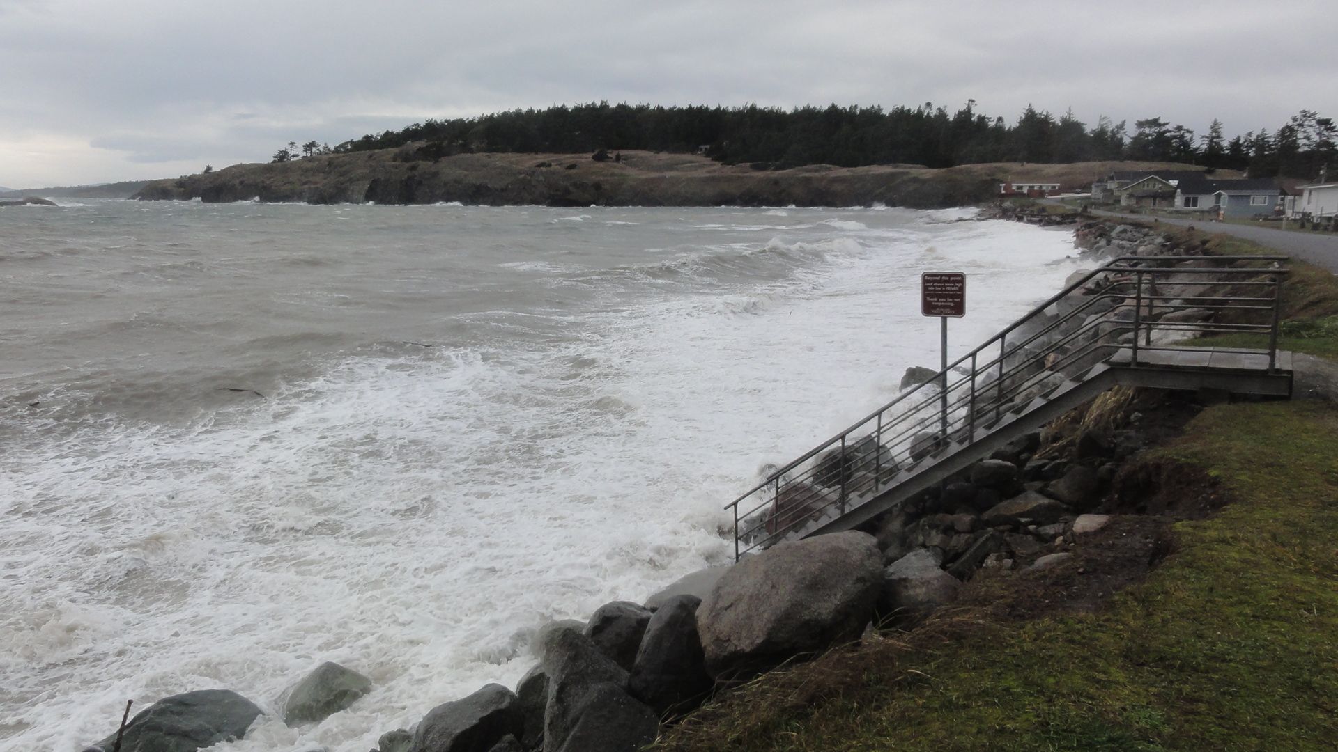
The landing was completely supported by the bank when it was built. Note how much the bank has eroded out from under in that time. Virtually all beach erosion here happens in these rare big storms. In between, nothing happens for months, so people assume it's stable. Then in one night big hunks of this glacial sediment deposit get carved away. If a big storm coincides with a high tide, the level of the water wil be higher than predicted, as the surface of the water gets pulled up into the low pressure above it. The combination of high water, big swells and high wind chews up anything in its path, especially if it's fairly soft, like this compacted sediment. I'll go out in a few days to see what's no longer there.
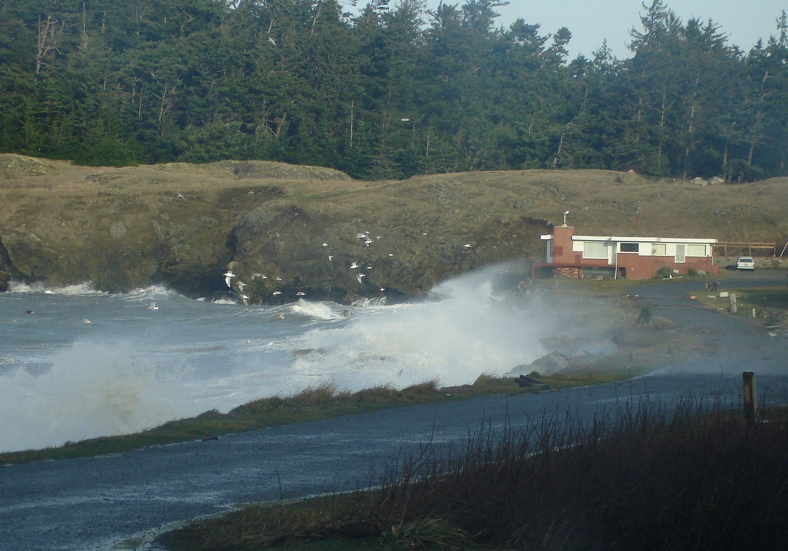
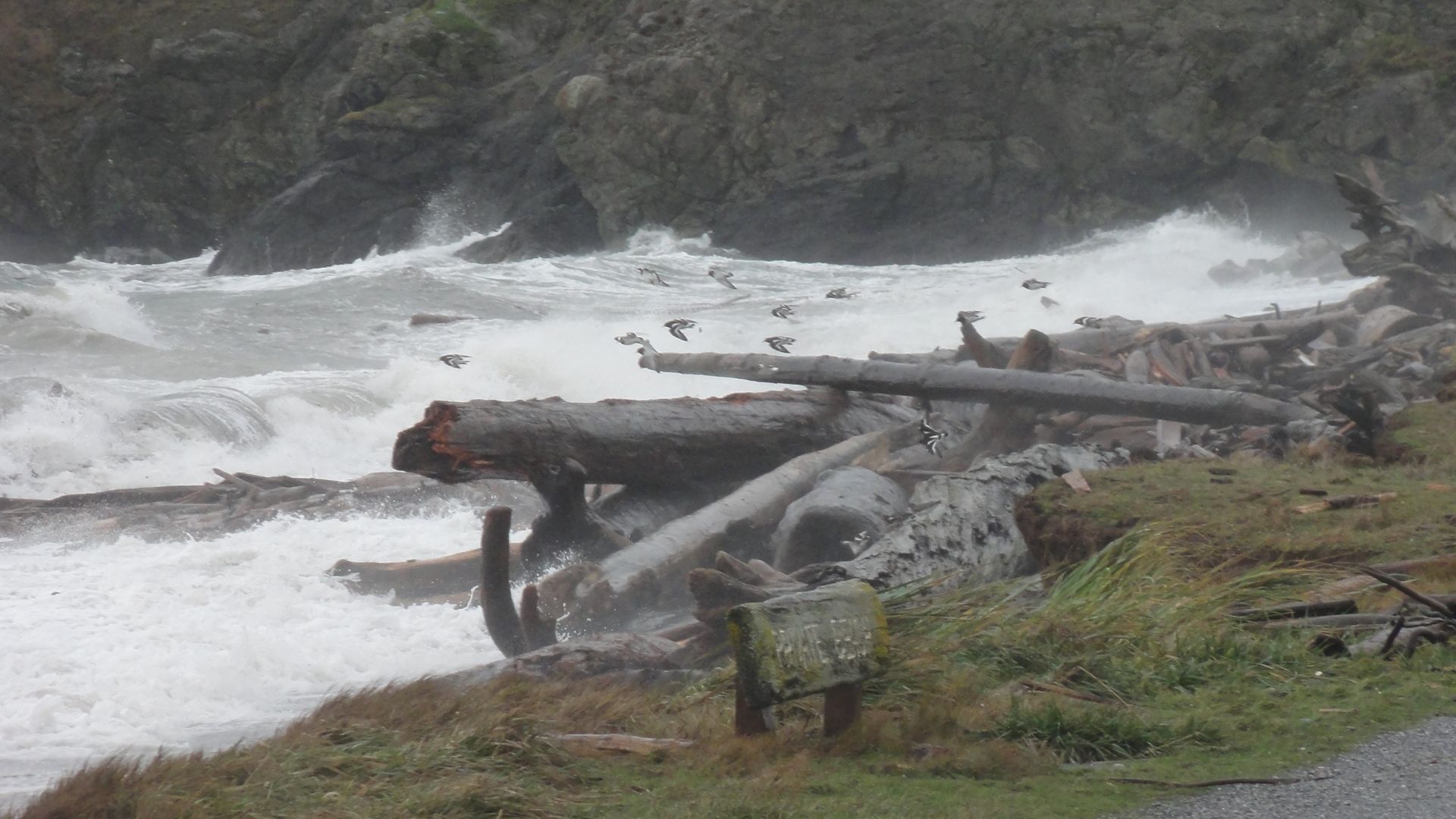
The county road is eroding along here, in spite of boulder riprap and driftwood. There will inevitably be a political crisis when it gives way and the residents have no access. Rebuild it in their front yards? Move it behind the houses into the wetland? We shall see.
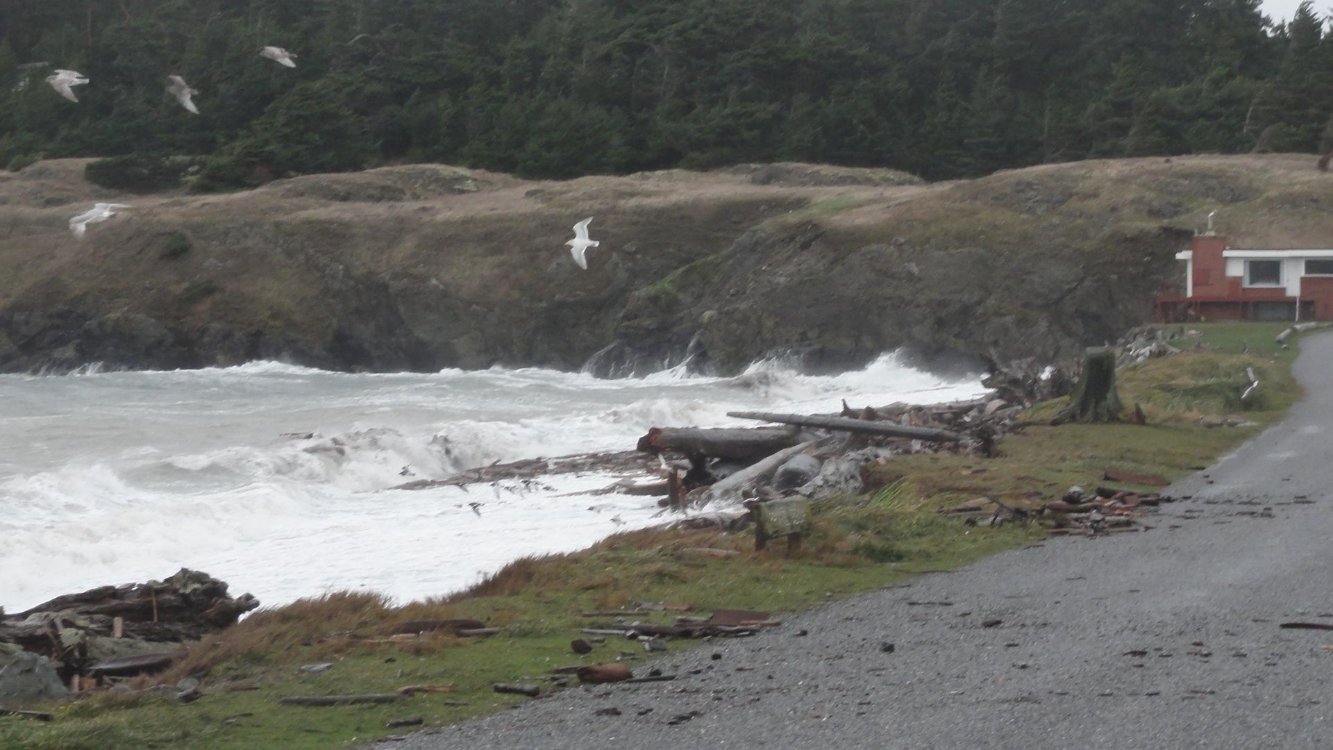
The woody debris on the road was thrown by the high tide waves. It would have been more dramatic to come out earlier, at high tide, but too dangerous. Getting hit with a chunk of driftwood windblown at 40 mph takes all the fun out of it.
A flock of scaups appeared to be playing in the wind, along with the gulls.
Around the corner, in Barlow Bay, it was much calmer, shielded by a headland. But you can see the surface of the water blown from the west around the little island. (That's our blue boat on the buoy out there)

Even in this relatively protected bay, sand was blown onto the road from the beach. At high tide there is no beach, but few storms come straight into Barlow Bay from the north, so erosion isn't as much a problem.
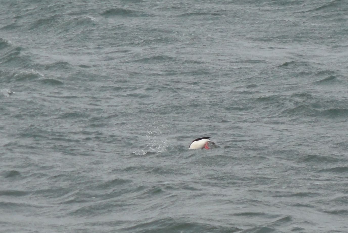
The birds there were unfazed by the swells and whitecaps. And regardless of wind and waves, our temperatures are almost always very moderate, even in winter. Here is a small contingent of the buffleheads that hang out here all winter. This bay is great shelter for marine birds (and boats).
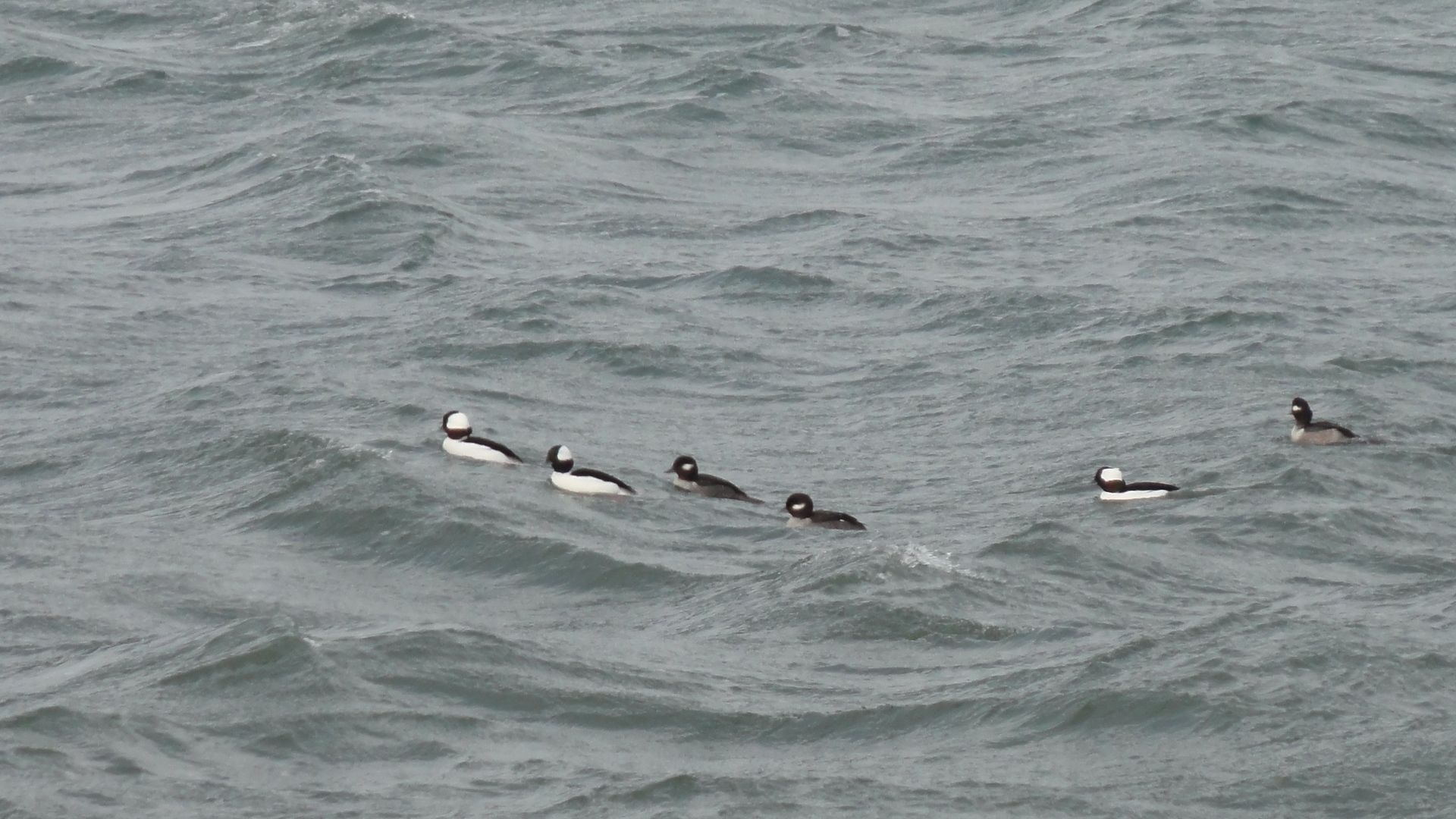
They were diving and feeding as usual. Love those red legs.
So what's the drama in your neighborhood lately? What weather makes you sit up and take notice? How does your wildlife manage winter tempests?
I'll be at work until midday PST...catch up with you then.
