On Easter, we drove down past Big Sur on California Highway 1, rightly considered to be one of the finest drives in the U.S., if not the world.
A few days after that, we headed up the other direction for a few days in Mendocino.
We visited several state parks and did some hiking. So let's take a road trip and look at some pics.
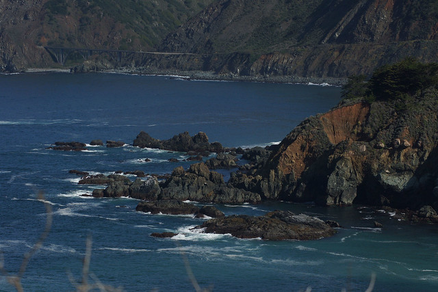
Big Sur Coast
I'm not perfectly sure, but I believe that is the Bixby Bridge in the rear of the photo. In any case, a nice sunny day makes for a lot of worthy viewpoints.
While the drive up and down the coast is "to-die-for" with scenic views, you don't want to take your eyes off the winding, curvy, narrow road. It's even harder when you're looking not to the left or right at the ocean, but overhead for birds.
And not just any birds, but the rare and endangered California Condor. As most of you know, Condors have been brought back a slight bit from the very brink of extinction, after the last free-flying Condor was trapped in 1987. At the time, there were 22 California Condors left in the world.
A breeding program has been run ever since, and groups like the Ventana Wildlife Society have helped bring the population back up to about 410 birds as of last September, including 230 flying wild.
As avid birders, we naturally hope to see Condors every time we are in the Big Sur area, but they are not always seen. We took a tour with Ventana Wildlife a few years ago and they showed us a hot-spot. About a mile or so north of the Big Sur Coast Gallery stands a beautiful home on a rocky point of land. There is a small pullout there, next to the driveway, that is prime Condor viewing if you're lucky. Mostly we have been skunked, but once we were treated to about a dozen Condors at the house, either resting on nearby trees, fences and roofs, or flying overhead!
Well, on Easter we were out of luck at the "Condor House," so continued on our drive south. But, the drive home that day was another story.
As I drove around a curve to the right, I noticed a few cars parked near a tree on the ocean side, with people gathered with cameras and binoculars. Fortunately there was a small pullout on the right side, because I noticed a huge dark bird in the tree as I drove past!
We grabbed our binoculars and crossed over to the tree, where we could easily see the rear view of a Condor sitting on a branch. I ran back to my car to grab my camera, and was treated to one of the most spectacular bird spectacles I've ever seen.
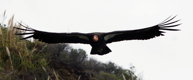
California Condor No. 335
The bird flew back and forth above us for about 15 minutes. It would go up the coast, swing over the hillsides, then back around to where we stood, enthralled and thrilled. All Condors are tagged, and you can see the numbers on this bird's right wing. You can also see a radio antenna to help scientists track the bird. And though we saw this one near the coast, the 9-year-old bird was actually released at Pinnacles.
With that, we headed home. A few days later I took some vacation time and we headed the other direction, north to Mendocino.
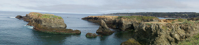
Mendocino Headlands
We actually drove up Highway 101 and then to Highway 128, through the amazingly beautiful Anderson Valley to the coast. A whole diary could be done on Highway 128, a narrow, two-lane highway winding through some great wine country of Northern California. But we were traveling mid-week, and few wineries were open that day.
On April 3 we decided to spend the day around the town of Mendocino. This is one of my favorite towns in California, and is not to be missed on any visit to this state. Mendocino has a great, green, artistic feel, and they are certainly glad for the visitors who feel as we. Town residents, wanting to preserve their spectacular coastline, many years ago arranged for the state to create Mendocino Headlands State Park, which surrounds the town on three sides.
It was a short walk from our hotel to the cliffs. From there, we were treated to some playful Harbor Seals in the cove below:
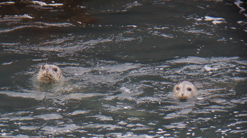
Harbor Seals
We also had some nice views of Black Oystercatchers:
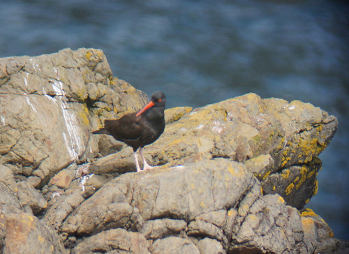
Black Oystercatcher
Another rock held a group of Brandt's Cormorants:
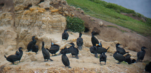
Brandt's Cormorants
Note the bright blue underneath the cormorants' bills, indicating the birds are in breeding plumage. In addition to the Brandt's Cormorants, there were quite a few Pelagic Cormorants, which are obvious in flight with white patches on the lower sides of their bodies, near the rump.
If you go at the right time of year, either spring or fall migration, the Mendocino Headlands offer fine whale watching as the animals head either north to Alaska or south to Mexican waters. They seem to travel closer to shore on the northbound journey, however. We were lucky enough to spot several spouts, and arching whale backs, from the Headlands. No breeching, unfortunately, but still some very cool sitings!
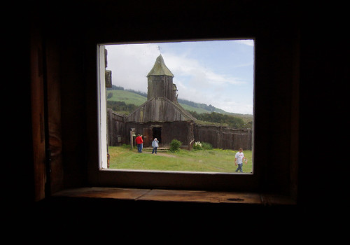
After walking back to the park visitor center to eat lunch, we hopped in our car to make a short drive north to the Point Cabrillo Light Station State Historic Park, a working lighthouse. It's a good half-mile from the parking lot to the lighthouse, so we got our hiking in on Wednesday!
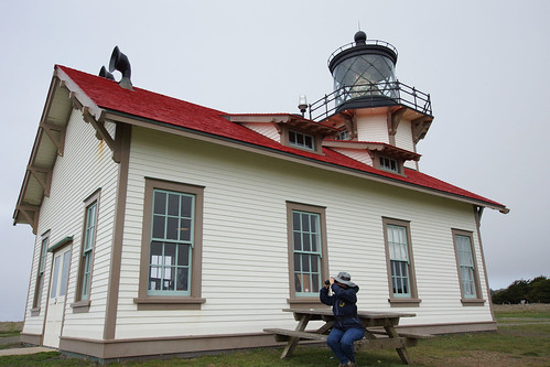
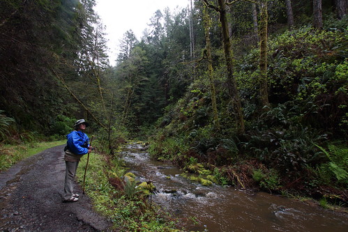
Ms. Unoball Looks for Whales from Point Cabrillo Lighthouse
The lighthouse, with a third-order Fresnel lens, is in beautiful condition, and there are some excellent exhibits inside, including much information on the nearby wreck of the opium brig Frolic, a shipping accident in 1850 that led to the founding of the town of Mendocino.
That was enough walking for one day. There were still other parks to visit the next day.
We awoke to rain on Thursday, but it was not heavy enough to put much of a damper on our hiking. We planned to visit three nearby parks, all of which are easily accessible off of Highway 1: Jug Handle State Natural Reserve, Russian Gulch State Park, and Van Damme State Park.
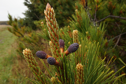
New Growth on Monterey Pine, Jug Handle State Natural Reserve
Jug Handle has some features of interest to geologists in that there are five wave-cut terraces formed by glacier, sea and tectonic activity that built the coast range.
Each of the terraces was uplifted from sea level about 100,000 years before the one below it. Plants on each terrace represent a more advanced stage in succession, indicating what the previous, next lower terrace may look like in 100,000 years. The lowest terrace consists of prairie; the second is covered with pines; the third supports a unique pygmy forest with knee-high trees possibly several decades old.
We weren't up to walking the 5-mile trail to see all of these features, however, so contented ourselves with a walk to the ocean cliffs and through the trees in that section.
It was raining harder when we got to Russian Gulch, so we ate lunch in the car and then walked along the cliff until we got to the Devil’s Punch Bowl, which is a large, collapsed sea cave with churning water. We were there at low tide so there was not much to see. I'll bet the Punch Bowl would be pretty cool during high tide, though.
From there, we drove south for about a half-hour until we got to our final stop of that day, Van Damme State Park.
Fern Canyon Trail, Van Damme State Park
The Fern Canyon Trail was perfect. The rain had stopped, the trail was flat and cool, and we were immediately greeted by at least two calling Wilson's Warblers. They were well hidden and shy, so I could not get any photos of them, but a very cool bird to find.
Coming from a much drier part of the state, it's always interesting to go to a place that is so wet. The plants are different, the birds are different, and it's just nice to be in moisture for a while. The Fern Canyon Trail was very aptly named, with many varieties of fern growing along the stream bank and hillsides.
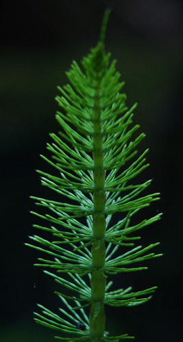
Giant Horsetail Fern, Van Damme State Park
There were other plants and flowers, too, including Western Trilium:

Western Trilium, Van Damme State Park
And always, the Little River.
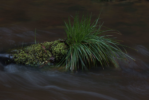
Little River, Van Damme State Park
That ended our stay in Mendocino. The following day, Friday, we headed home. The decision: To return the way we came, or to take the longer route and keep on Highway 1?
Well, I figured, since we were leaving early and the wineries of the Anderson Valley would still be closed by the time we drove through, we might as well drive the coast. That does make for a much longer drive, as the corkscrew highway means slow driving. We also kept the speed down to admire the views, and took plenty of photo stops and other breaks.
The main reason we wanted to drive along the coastal highway, however, was to visit yet another state park, Fort Ross State Historic Park.
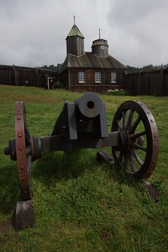
Cannon at Fort Ross State Historic Park
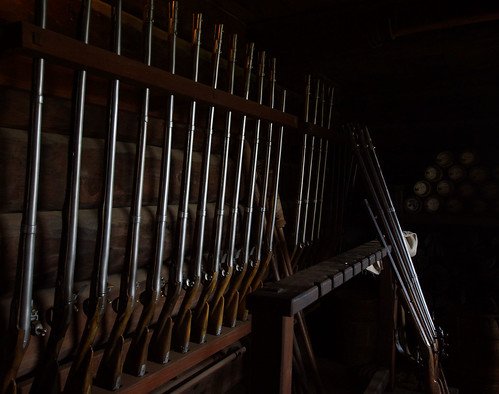
Armory at Fort Ross State Historic Park
Russian Chapel at Fort Ross
Fort Ross is quite an interesting site. From 1812 to 1841 the Russian-American Company set up a small farming colony in what was actually Spanish, then Mexican, territory. They used the farms and ranches to provide food and supplies to their colony in Alaska, because Alaska conditions were not conducive to agriculture.
And with that, we continued our drive back home, only leaving the cliffs and coast when we had to make our way from the Golden Gate Bridge through San Francisco, before we picked up Highway 1 again at Pacifica. (This allowed us our first drive through the new Tom Lantos Tunnels through the mountains outside of Pacifica, otherwise known as the Devil's Slide. Very cool, for tunnels!)
One of the things that I hope you all notice in this diary is our interest in nature and wildlife, and specifically in birds. One of the main things that has helped us with local birding is the Santa Clara Valley Audubon Society.
Now, SCVAS needs our help, and I need your help. I know this is long, but read just a little more!
Audubon Needs Your Help
One of the ways that we have learned about California birds, bird sites, and the local outdoors in general, has been to go on field trips sponsored by our local Audubon chapter, Santa Clara Valley Audubon Society.
This organization has been fun and helpful to us in many ways since we moved to San Jose and became birders.
Now, SCVAS needs our help, and I need your help. On April 20, my wife and I will be participating in a Birdathon fundraiser for SCVAS. This is their biggest fundraiser every year. Simply put, we raise money by going out and counting birds. Some donors pay per species seen, but most give a flat fee for our effort.
SCVAS is one of the leading environmental organizations in the San Francisco Bay area. They have been leading the fight in habitat and wildlife protection, and more.
Money raised also goes to wildlife education efforts, particularly the Wetlands Discovery Program that brings thousands of elementary students to wetlands each year. As you can imagine, for some poor students especially, this is their first introduction to birds and their environment.
So, please help us support these great programs. Our goal this year is to raise $2,500, and we won't be able to do that without you.
As usual, I am teamed up with my wife to raise money, and we are asking that all donations be in her name. Donating is very simple.
Go to the Sponsor a Team Member page and use the pull-down to select my wife's name, Carolyn Straub. From there, just use your credit card or PayPal account to make a donation in her name.
Of course, no money donated goes to her; it all goes directly to SCVAS. All donations are tax-deductible. If everybody who sees this can give even $20, we'll be well on our way to reaching our goal. Every amount helps!
I got a lot of support from Kossacks last year, and I'm really counting on you all again. The Birdathon is almost here, so this is our last-minute push!
If you've appreciated this diary, and if you have some money you can afford to donate to a great cause, please be as generous as you can.
Thank you for anything you can do!

