This is a new step in the series of maps finding the limits for a Democratic Gerrymander. Today's maps are about Colorado.
I recently published als maps for Minnesota and Iowa. It requieres a work to find the limits, and I have been doing alternatively the three maps until I have been convinced about them. It is the reason why all them come together at same time.
In the case of this map about Colorado, I was in the limits some time ago, but with so ugly maps. It required a time to find this way to be still in the limits but with a nicer solution.
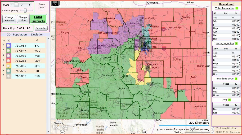
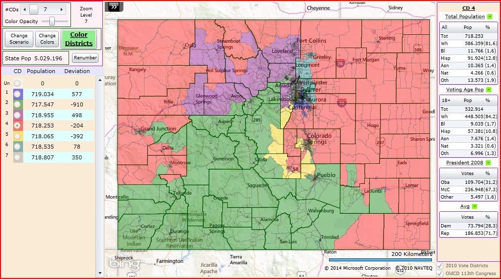
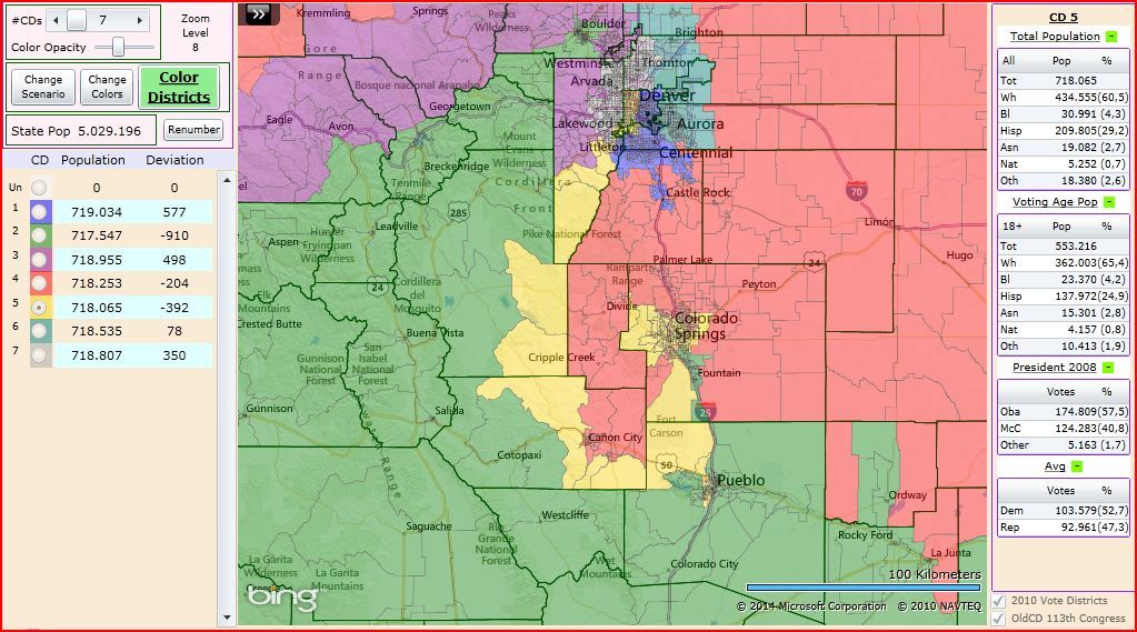
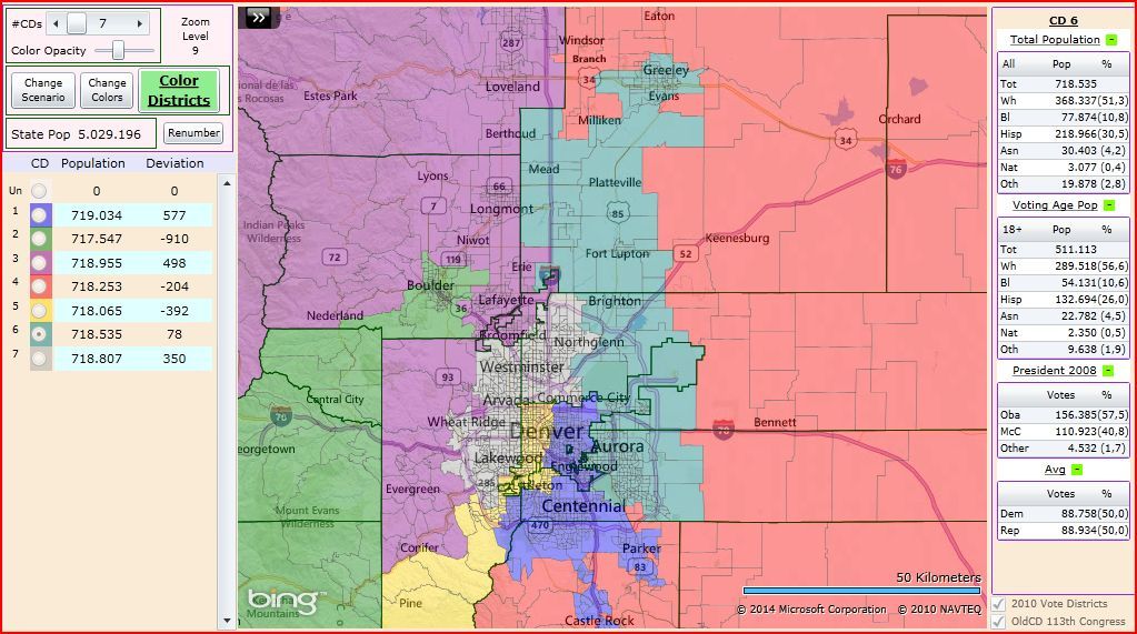
The result of the work gives 6 Safe D districts that are D+5 according to Obama 2008 results, and one Safe R district that is R+22 and is very close to the reddest possible district that can be drawed in Colorado.
Go in to see the maps. I wish to remember you that the purpose of this series is to find the most Democratic map for Colorado. It means to have the maximum number of districts in a level that we can consider Safe for the Democratic party, and to make the rest of the districts as Democratic as possible. Sometimes ugly maps, not well done, are called unproperly Democratic Gerrymanders. I think it is necessary that the people see where are the real limits for a Democratic map. In this case the limits for a Democratic map of Colorado.
Overall map:
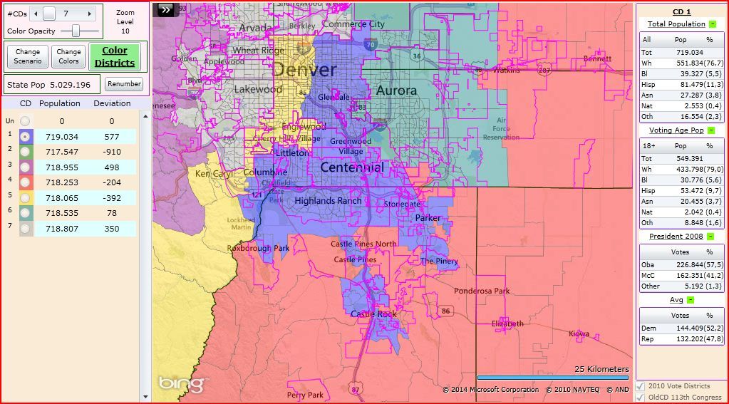
CO-01: D DeGette (D)
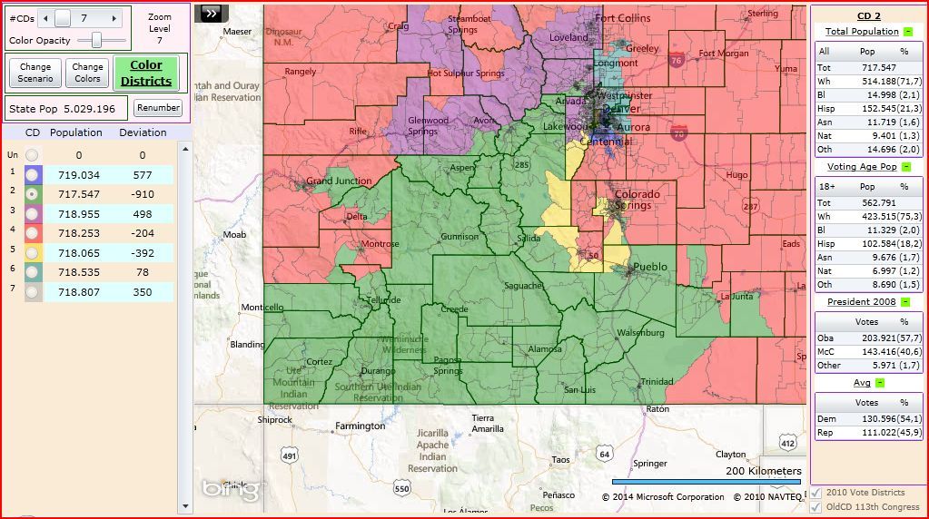
CO-02: J Polis (D) and S Tipton (R)
CO-03: Open by R
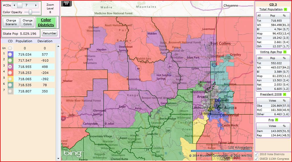
CO-04: D Lanborn (R)
CO-05: Open by R
CO-06: M Coffman (R)
CO-07: E Perlmutter (D)
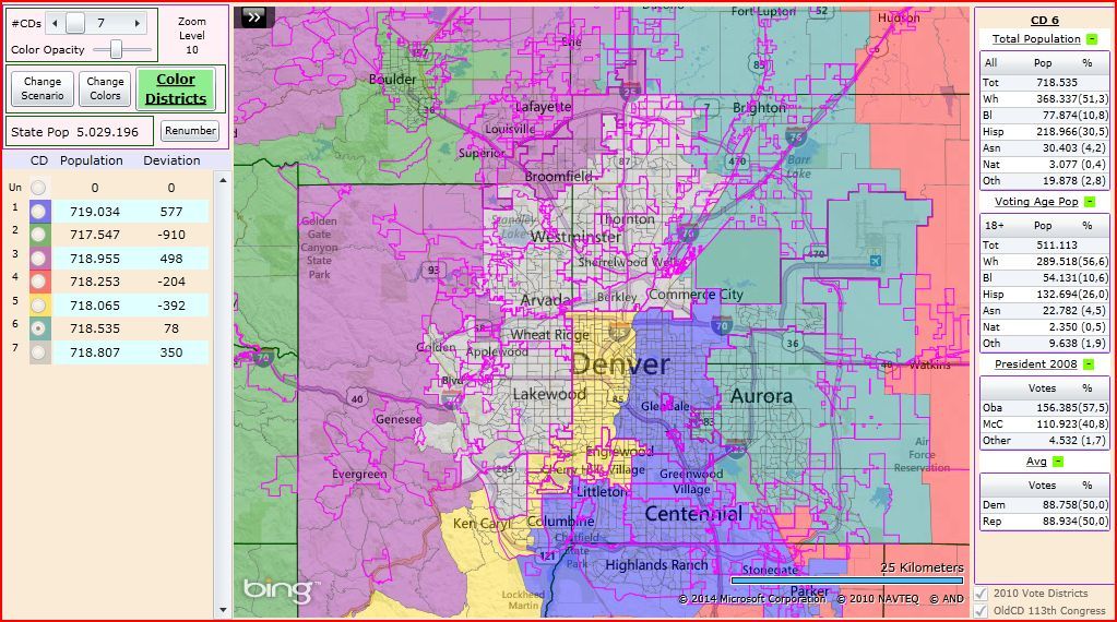
Note that the pink lines in some maps are the city borders.
In this case CO-02 is a little over the safety level. To make the ideal map for this safety level, CO-02 should be down until 57.5% Obama 2008 and CO-04 should up a little. But I wanted you see this version because here CO-04 is very close to the reddest district that can be drawed in Colorado. It was very low room to improve CO-04 after making safe D the rest of the districts.
FINDING THE LIMITS FOR A DEMOCRATIC MAP FOR THE US HOUSE
01.- Hawaii 2D-0SD-0SR-0R map
02.- Vermont 1D-0SD-0SR-0R map
03.- New York 27D-0SD-0SR-0R map (28-0 then still)
04.- Rhode Island 2D-0SD-0SR-0R map
05.- Maryland 8D-0SD-0SR-0R map
06.- Massachusetts 9D-0SD-0SR-0R map
07.- California 53D-0SD-0SR-0R map
08.- Delaware 1D-0SD-0SR-0R map
09.- New Jersey 10D-0SD-0SR-2R map
10.- Connecticut 5D-0SD-0SR-0R map
11.- Illinois 18D-0SD-0SR-0R map
12.- Maine 2D-0SD-0SR-0R map
13.- Washington 10D-0SD-0SR-0R map
14.- Oregon
15.- Michigan
16.- New Mexico 2D-1SD-0SR-0R map
17.- Wisconsin
18.- Minnesota 6D-0SD-1SR-1R map
19.- Nevada 3D-0SD-1SR-0R map
20.- Iowa 3D-0SD-0SR-1R map
21.- New Hampshire 0D-2SD-0SR-0R map
22.- Pennsylvania
23.- Colorado 6D-0SD-0SR-1R map
24.- Virginia
...
From a total of 178 seats, the maps for these 19 states are showing a potential of:
- 168 safe seats for the Democratic party.
- 3 swing seats with a Democratic lean (SD) and Democratic incumbents.
- 2 swing seat with a Republican lean (SR) and Republican incumbents (except C Peterson).
- 5 safe seats for the Republicans.
Then 172 of 178 seats would be in Democratic hands taking into account that C Peterson would run as incumbent. It gives a potential improvement of 44 US House seats (all them from 11 of the 19 states).
When a 27-0-0-0 map for NY can be done, it means that every option under this level can be drawed (26-1-0-0, 26-0-1-0,...). Only it is necessary to define the requirements. With lower level of requirements nicer looking maps can be done.
Being a person that like the doable things, I'm looking first to the states where the Democratic party has better chance of being in control of the Redistricting process. While the maps for Oregon are ready in the DRA (David's Redistricting Application), the next step should be Michigan. It will take time until the following redistricting diary.
