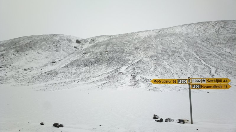
Winter has arrived in Reykjavík. The weather is cold and crisp. Snow lies on the ground and winter winds from the last storm are dying down; many drivers got caught unawares and there were a number of fender benders. The northern lights have been shining almost every night.
And the Mist is gone.
It was gone two days ago. It was gone yesterday. And it was gone today. I sincerely hope it stays gone for quite some time. My available daylight to work outside keeps disappearing so it's nice not to have the pollution limiting what I can do. I can't tell you how nice it is to look off into the distance and see little to no blue.
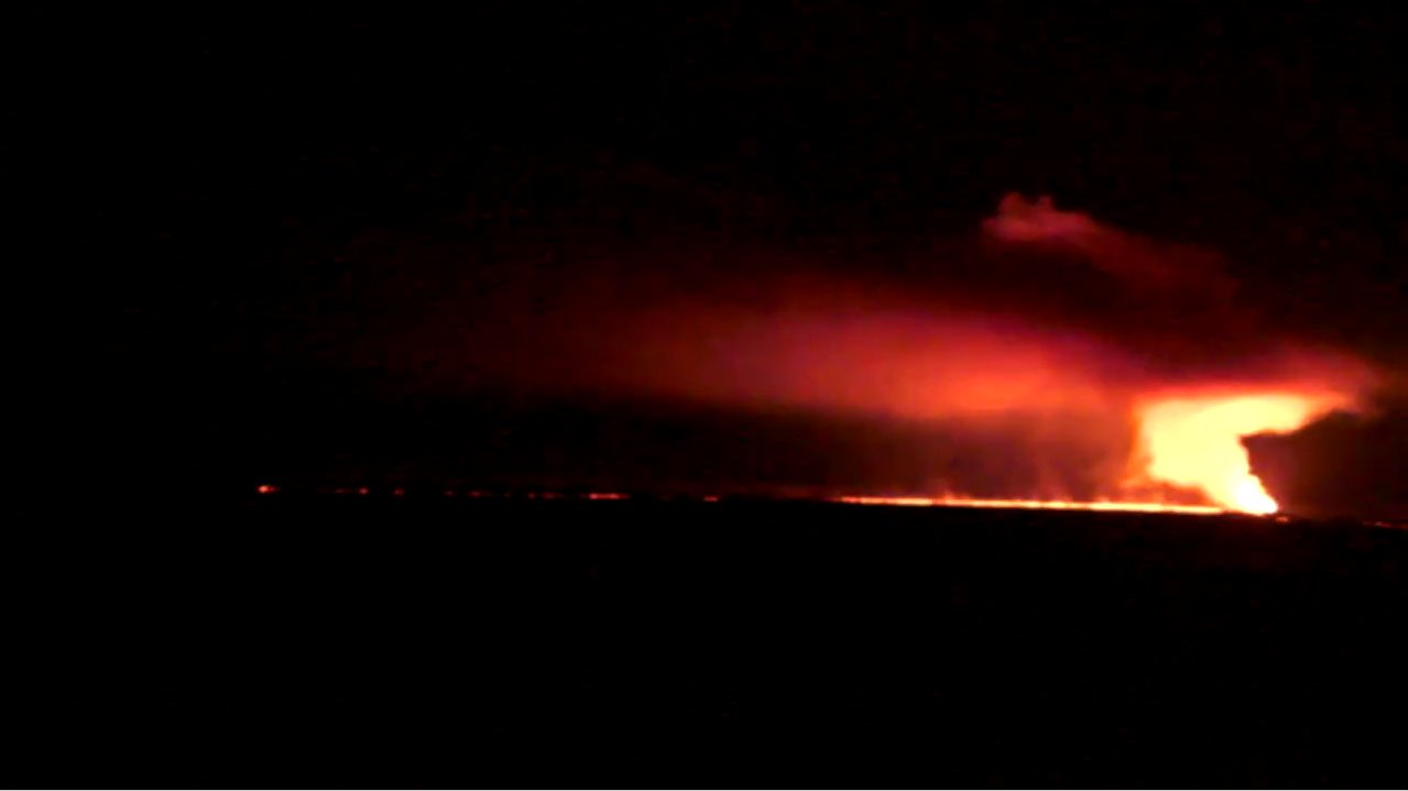
But the eruption is still going. And the pollution is still coming. And it clearly doesn't want us to forget its intensity with how much it's blowing in the east.
Join us below the fold.
The highest pollution episode thusfar during the eruption was 5800 µg/m³ in Mývatn. Well, today Höfn in the southeast nearly broke that with 5400 µg/m³. It's then moved on to strike other areas like Landsbrot and Kirkjubæjarklaustur at 2600 µg/m³ Many more areas have clearly been hit, but meters are still few and far between. It's expected next to hit the north and northwest before turning back to the northeast.
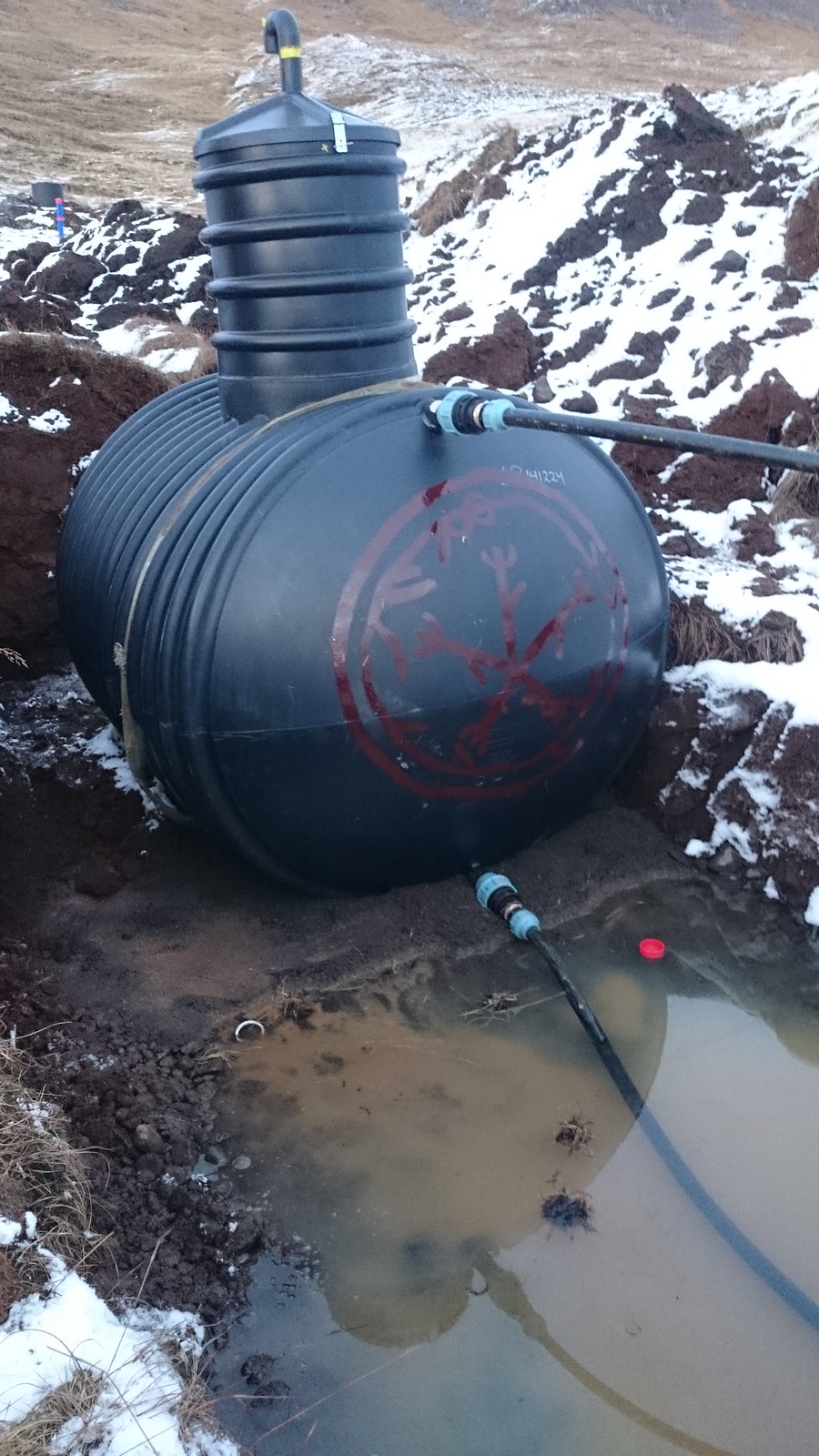
I don't wish this on other people... especially given that the eastern part of the country is much closer to the eruption and gets a stronger plume than we do. But I do plan to enjoy whatever breather - literally - we can get from the Mist. The other evening I painted runes on my now-connected water tank in advance of him being buried tomorrow:
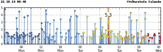
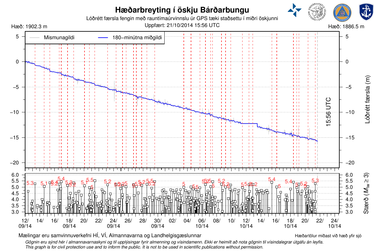
So those of you who get USGS earthquake alerts, like me, have been getting pestered quite a lot lately ;) These correspond with no shortage of subsidence:
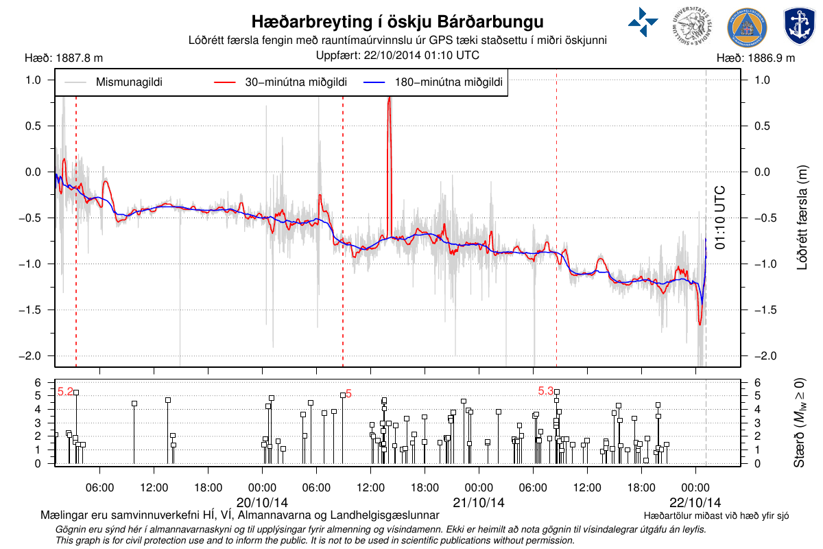
What we want to see on the long term trend is a strong curving shape - steep in the beginning, flat near the end, indicating that the amount of subsidence is nearing an end. But it's not.
Don't get me wrong - while it may look like it, it's not a straight line. A strait line corresponds to the black line I've drawn in, below:
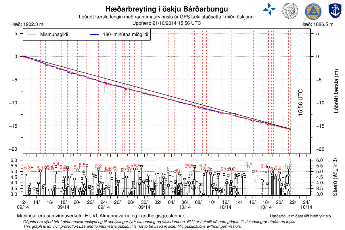
The two red lines seem a much better fit - a slightly faster drop in the beginning (nearly 50 cm per day), and a slower but still steady drop since then (a bit under 40 cm per day). The stability and long persistence of the current slope is not a good thing when one wants to see the eruption show some signs of ending.
Should a Jökulhlaup occur to the north near Dettifoss, wouldn't it be nice to have a bridge designed to tolerate massive foods rather than the current, more conventional bridge? The roads service sure thinks so, and is preparing to build one. There's only one problem: the risk of the very floods they want to prepare for make it too dangerous to build the replacement bridge.
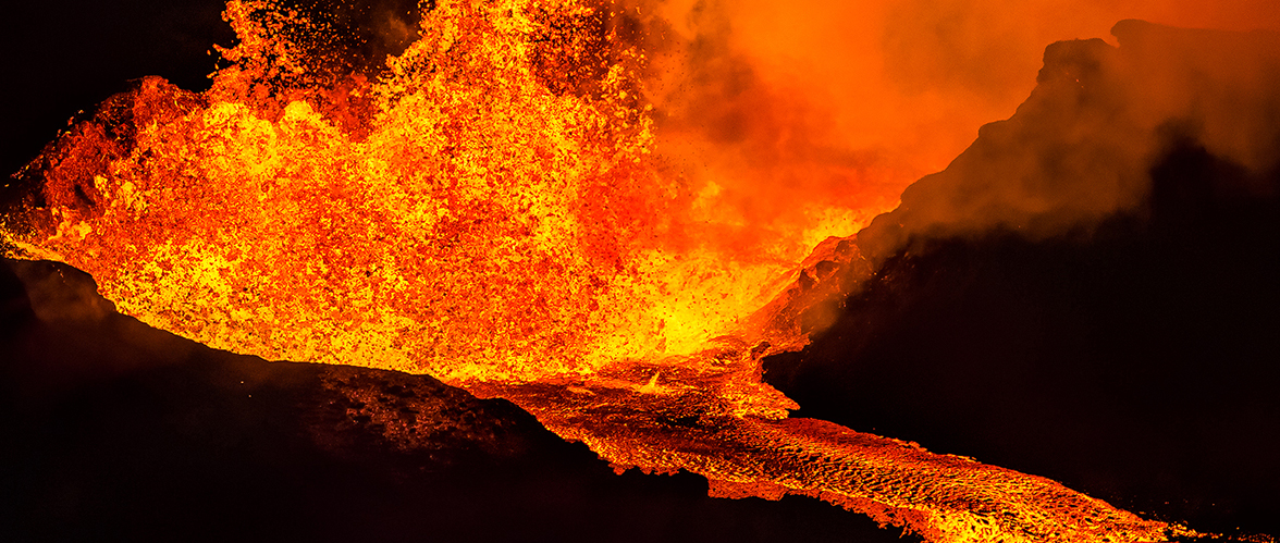
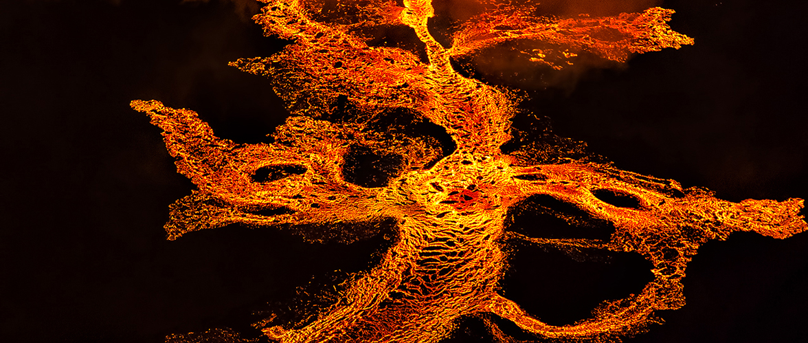
The expansion of the lava flow continues along the same path as the previous update - slower expansion in the area of the road to the north, moderate expansion on the southern side, and lots of thickness building.

(Credit: Jarðvísindastofnun Háskólans)
The total area is now 60,7 square kilometers.
People of course keep trying to break into site to see the eruption, despite the weather. But now that our government has decided to secretly equip beat cops with machine guns from Norway, I bet that'll keep them out! (This is why you don't elect conservatives, people!)
I had hoped to attend a meeting today about was waylaid by a number of other tasks, including a flat tire that necessitated an early switch to winter tires. It's also limited my time to provide new pictures and videos for you all today. :( But I figured some little update is better than none! Sorry, and I'll try better next time. :)
(Credit: Zoë Robert)
(Credit: Zoë Robert)
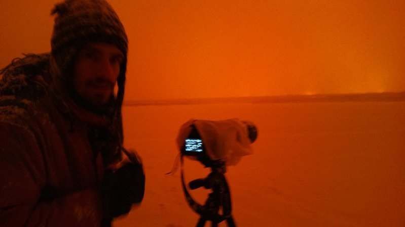
(Credit: Zoë Robert)
(Credit: Iceland Photo Tours)
(Credit: Iceland Photo Tours)
Update, 21:00: No update tonight, sorrí!
Update: Or tonight either.
