Today's Terra Imagery from NASA shows a sheen of oil offshore of Port Arthur, near Beaumont Texas.Oil may begin coming onshore on Texas beaches. There's a strong liklihood that black area is weathered oil below the water's surface coming ashore on barrier islands southwest of Galveston, Texas.

And to the east in deep and shallow water a toxic mass of oil in the water column threatens to poison and smother the corals and fisheries of the west Florida shelf. PDF
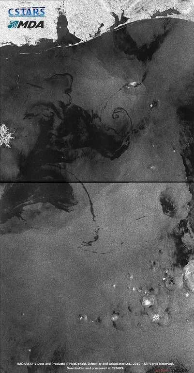
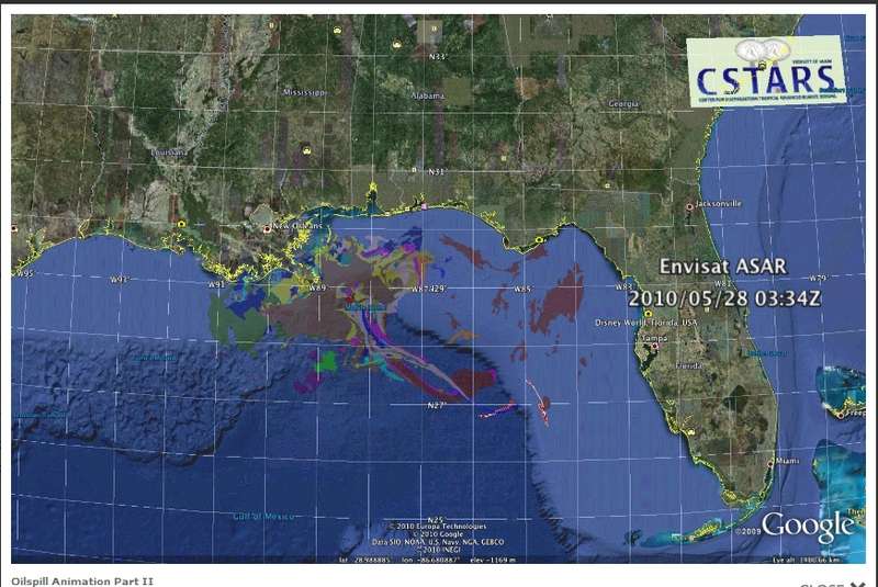
On satellite radar, which can see through clouds, oil appears black May 29 radar imagery shows oil very near Mississippi and west Florida panhandle beaches. The combination of images shows oil spread from near Pensacola Florida to near Galveston Texas.
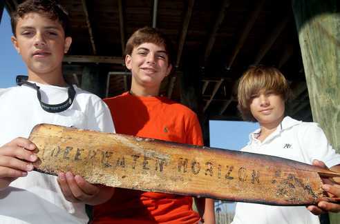
Oar found on Horn Island, Mississippi.
The waters of most of the Florida shelf are protected by winds and currents from surface pollution entering from the main body Gulf of Mexico.
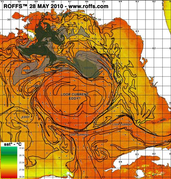
Based on a study of 194 floating probes released into the Northeast Gulf of Mexico during a 1-year study in the 1990s (Figure 3), the west coast of Florida from Tampa Bay southwards to the Everglades is at minimal risk of receiving oil from surface currents. There is a "forbidden zone" off the southwest Florida coast where the shape of the coast, bottom configuration, and prevailing winds all act to create upwelling and surface currents that tend to take water away from the coast.
However, the Florida shelf is vulnerable to oil entry from deep water because the wind driven upwelling pulls deep water onto the shelf from the main body of the Gulf.
The decision by BP and the EPA to use deep water dispersants is helping to spread a toxic, suffocating cloud onto the rich fishing grounds of the Florida shelf.
"It's probably going to be one of the worst disasters we've ever seen," said Paul Montagna, a professor of ecology at the Harte Research Institute for Gulf of Mexico Studies at Texas A&M University in Corpus Christi.
"Instead of creating a typical spill, where the oil goes to the surface and you can scoop it up, this stuff has been distributed throughout the water column, and that means everything, absolutely everything, is being affected," he said.
A huge invisible, toxic cloud of oil is welling up into the Florida shelf. It is likely, but not yet proven, that dispersants kept the oil from rising to the surface. If this oil had gone to the surface it could not threaten the Florida shelf this way.
Larry McKinney, executive director of the Harte Research Institute for Gulf of Mexico Studies at Texas A&M University-Corpus Christi, said the DeSoto Canyon off the Florida Panhandle sends nutrient-rich water from the deep sea up to shallower waters.
McKinney said that in a best-case scenario, oil riding the current out of the canyon would rise close enough to the surface to be broken down by sunlight. But if the plume remains relatively intact, it could sweep down the west coast of Florida as a toxic soup as far as the Keys, through what he called some of the most productive parts of the Gulf.
The plume was detected just beneath the surface down to about 3,300 feet, said David Hollander, associate professor of chemical oceanography at USF.
Hollander said the team detected the thickest amount of hydrocarbons, likely from the oil spewing from the blown out well, at about 1,300 feet in the same spot on two separate days this week.
CSTARS overlay of images from May 18 to 28.
The toxic oil cloud cannot be seen by satellite or areal photographs.
Oil was found suspended at depth in the De Soto canyon area near Pensacola.
This oil at depth in cold water will break down very slowly while depleting the oxygen. This could create a dead zone in an area that is normally highly productive. As the cloud of oil moves up onto the Florida shelf it will endanger the ecosystem.
Update
A commenter raised the question "Is oil really as far west as Texas" ? Only actual measurements on water samples prove that oil is in the water. However, continuity of oiled areas from day to day, moving in directions consistent with winds and currents, is a good way to double check observations.
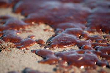
Oil washed up on beaches west of the Mississippi delta about a week ago. Grand Isle Beach was closed on May 21. The Audubon society posted this photo of the oiled beach at Grand Isle, LA on the 23 of May.
The longshore currents this time of year are known to flow from this area of Louisiana towards Texas. Oil west of the Mississippi delta has stayed west of the delta.
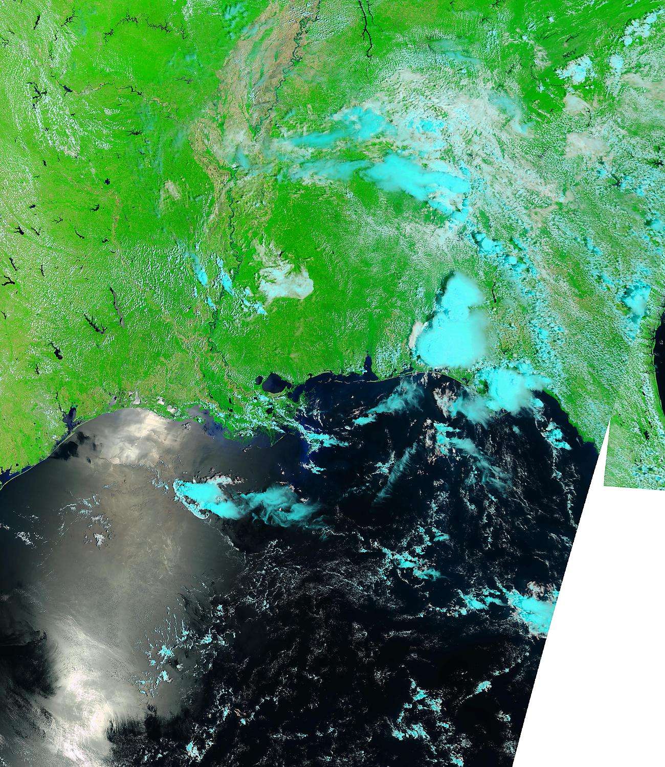
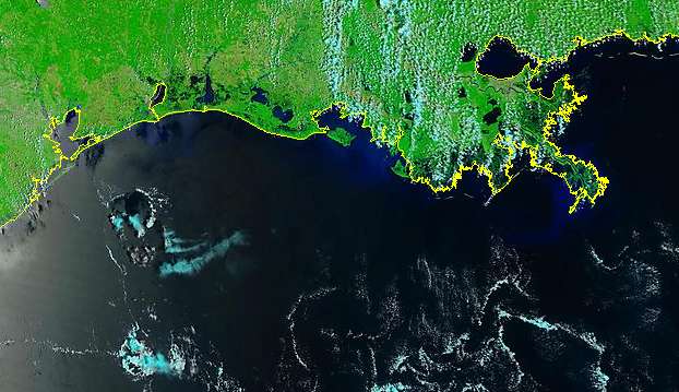
Terra false color imagery shows a swirling turbid water mass off of southwestern Louisiana, approaching Texas on May 27.
Terra false color May 27, 2010
Terra false color May 29, 2010. The swirling sheen in the northern Gulf has a very different texture from the bright sunglint in the southern Gulf. The swirl in the north looks similar to swirls near the blown oil rig.