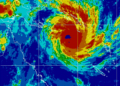
Huge Cyclone Yasi is rapidly intensifying as it moves towards flood ravaged Queensland, Australia. Land soaked by 4 months of the heaviest rains in Australian history now faces potentially one of the strongest tropical cyclones to strike Australia.
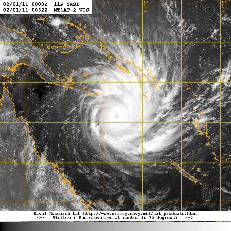
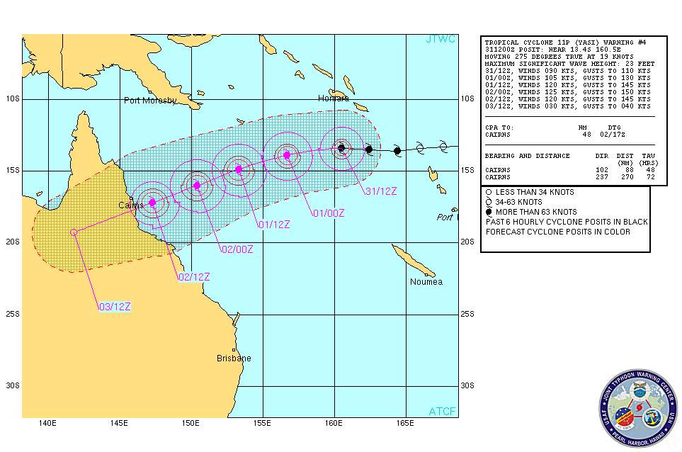
Yasi is forecast by the U.S. Navy to make landfall as a strong category 4 storm of 125 knots (145mph) in north Queensland, south of the Great Barrier reef resort town of Cairns.
Update new image
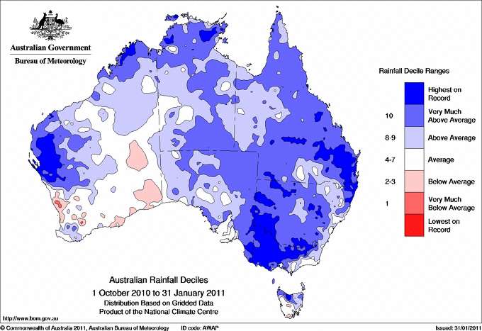
The east coast of Australia has been deluged by record and near record rainfall for the 4 month period of Oct. 1 - Feb. 1. An enormous area of Queensland has been flooded.
Now Queensland faces the onslaught of Yasi, forecast to be one of the largest and strongest tropical cyclones in Queensland's history.
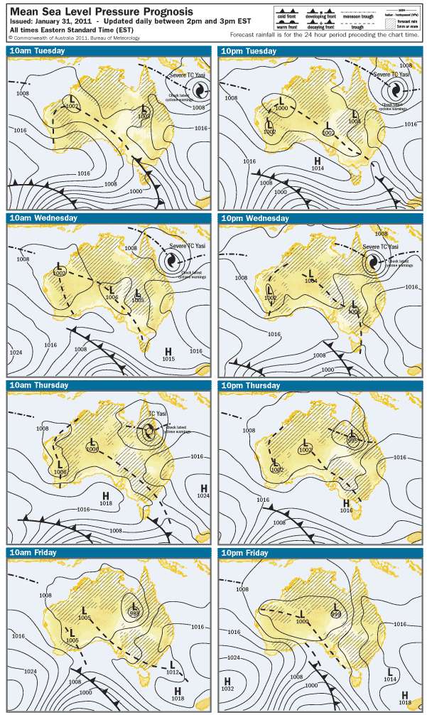 image source: Australian Bureau of Meteorology
Thousands of residents, as well as patients at Cairns hospital, face the prospect of evacuations today as the huge storm front bears down.
Latest modelling indicates the cyclone has moved slightly north and is now due to cross the coast between Tully and Lucinda, about 140 kilometres north of Townsville.
Once Yasi passes inland heavy rains will continue to threaten Queensland with flooding as the remnant low pressure draws in monsoonal moisture from the tropics.
Senior forecaster Gordon Banks says Yasi has the capacity to affect a large swathe of the state as it heads inland affecting places like Richmond, Hughenden, Cloncurry and eventually Mt Isa.
A weak tropical cyclone, Anthony, made landfall south of Townesville, near Bowen late last week, causing minor flooding. Yasi is forecast to come ashore to the north of Anthony's landfall. Yasi will bring heavy rains across areas already near or above flood stage.
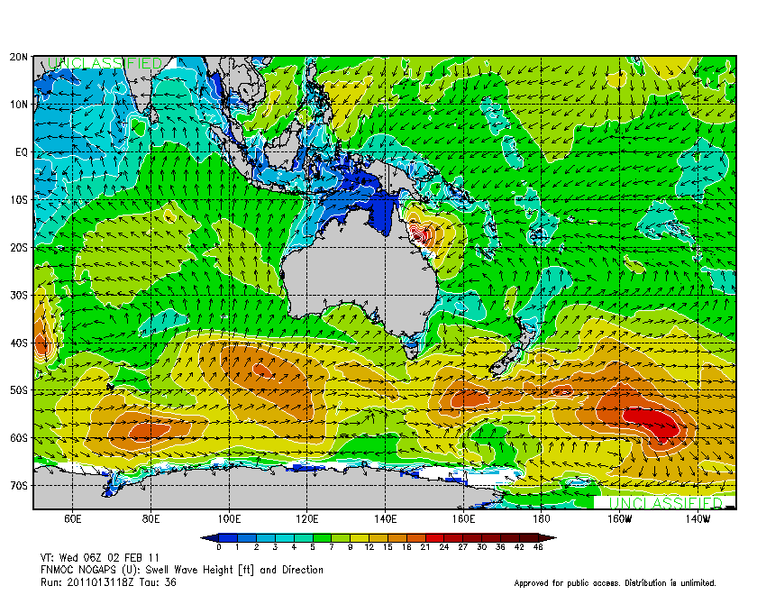
Yasi's large size and strong winds will combine to develop a strong and damaging storm surge. Moreover, Yasi threatens to come ashore at high tide (This coast of Australia has a large tidal range). The Great Barrier reef will tend to attenuate the storm surge, but very heavy damage can be expected in coastal areas along the leading south-west sector of the cyclone.
Update from GlowNZ's comment
