People have been asking me for a long time for pictures of the caldera. They see the graphs of the great levels of subsidence and often expect to see a giant bowl. But while there've been dozens of meters of subsidence, it's over an area the size of Manhattan - to view the whole thing you have to be so far away that the slope downward is almost imperceptible.
But what's much more perceptible are the smaller sigkatlar, the ice cauldrons which ring the descending plug. And they're concerningly both growing and increasing in number. But first... the aftermath in Höfn.
Join us below the fold.
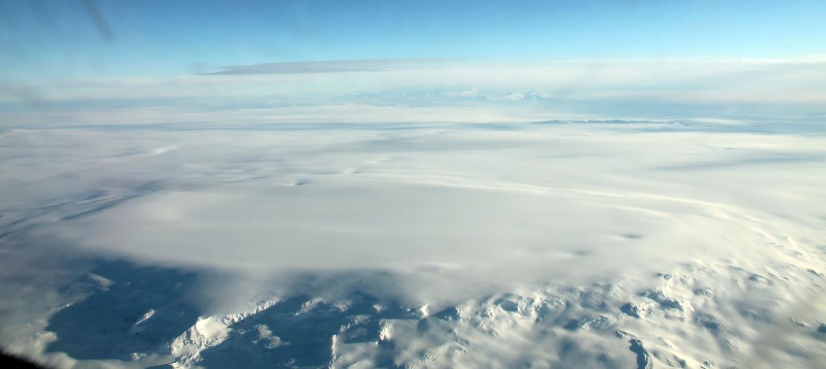
The mist keeps drifting around the south and southeast:
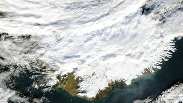
Credit: NASA / LANDSAT
In the past few days, our reaction to pollution levels in the lower-thousands of µg/m³ in the area is of relief rather than alarm. 1800 µg/m³ in Höfn today? Whew! It's still terrible to breathe, mind you, but versus the tens of thousands in the Höfn area the other day, most people would gladly take a thousand or two.
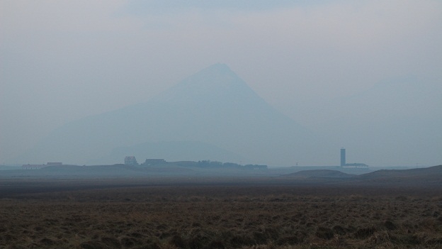
Credit: RÚV
The biggest concerns were asthma patients and those with other breathing conditions. Doctors took the time to call every patient in the area (despite being on strike). Every last one of them was aware of the situation and following instructions. As a consequence, serious short-term health problems seem to have been avoided, although lesser symptoms such as pain in the eyes, throat, a bad taste in the mouth, etc were widely reported. Outdoor activity since the evening spike has been reduced, despite the "lower" levels. Most people outside wore a damp cloth or scarf over their face. While people are following instructions out of general trust for the authorities, they sometimes express confusion or frustration with not knowing whether what they're doing is actually helping or not. They were also frustrated by the fact that the pollution meters weren't yet net connected so they couldn't keep up with what's going on, despite being the closest town to the eruption. And what is there lost power at one point during the pollution event.
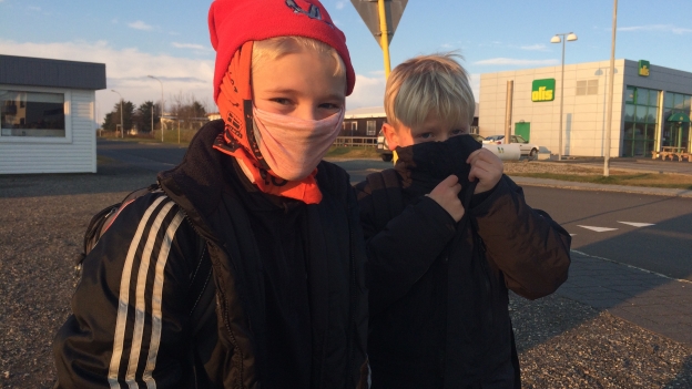
Credit: RÚV / Rúnar Snær Reynisson
The pollution event is not confined to Höfn and is rather also affecting areas all along the south to southeast, with levels up to 6600 µg/m³ at times. The pollution is in popular tourist sites like Skaftafell:
Credit: Me, during a hike the previous summer
And Jökulsárlón:
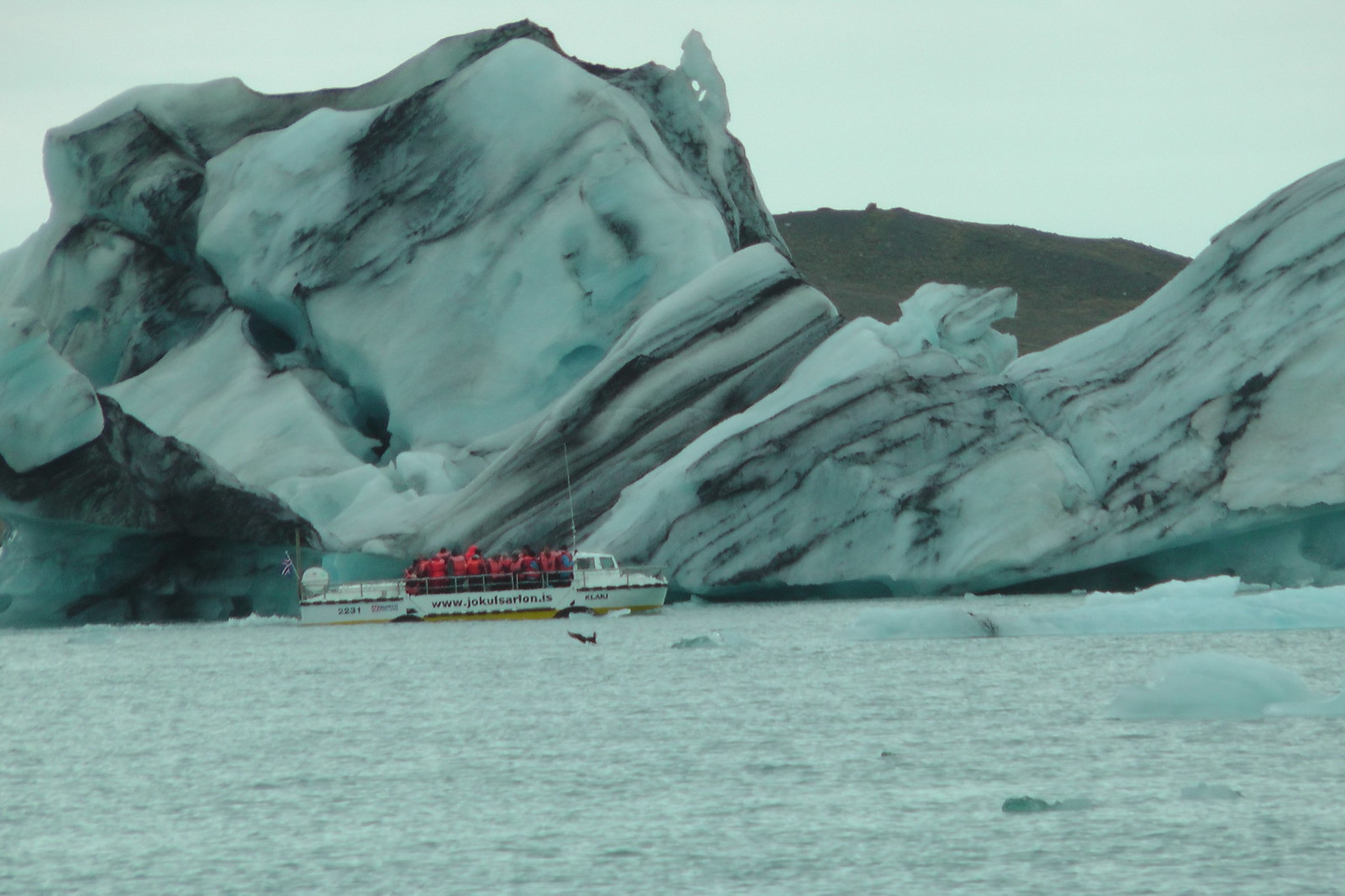
Credit: Me, family trip around the country
A tourist ship operator in Jökulsárlon says that he had lots of tourists who didn't know what was going on come up to him very worried complaining about the symptoms. He said that once he explained to them that this was connected to the volcano, which most of them had heard of, they reacted much better to the news. What he found most noteworthy of the symptoms was the strong taste the gas left in his mouth, which he said there is no adjective to describe, apart from that it's a "thick taste".
Increasingly, it looks like the short-term health effects of these pollution events, despite how high they're getting can be managed by behavior adjustment during the spikes - so long as people are kept suitably informed as to what is going on. What the long-term health effect will be is, however unknown.
The health effects, of course, don't just apply to people. The Icelandic Veternary Authority sent out an announcement encouraging all animal owners to as much as possible keep their pets and livestock from stressing themselves outdoors during the pollution events. Animals too should be monitored for pollution symptoms such as red eyes, coughing, and difficulty breathing, and should be housed as best as possible.
There's been little discussion on what affects this will have on plant life, despite plants being known to be very sensitive to sulfur dioxide levels, even during winter.
The prestigious scientific journal Nature has an excellent article about how the gasiness of this eruption caught all of the experts offguard, who were busy preparing for another ashy eruption. Among some of the details mentioned by the article: SO2 emission rates are being measured by two types of spectrometers but both rely on sunlight which is in short supply this time of year; they say they don't expect widespread climate disruptions due to the low altitude emission of the plume; they mentioned that in the world's last SO2-comparable eruption event, that of Mount Oyama on Japan's Miyake-jima ("Gas Mask Island"), the government simply evacuated the whole island; and they refer to what we here are living through as "an unprecedented experiment in testing the effects of toxic-gas exposure".

Where's my free feed pellets, dammit?
In other news: snow snow fire snow lava snow pretty fire snow.
Credit: Vísir / Egill
Credit: Vísir / Egill
Credit: Vísir / Egill
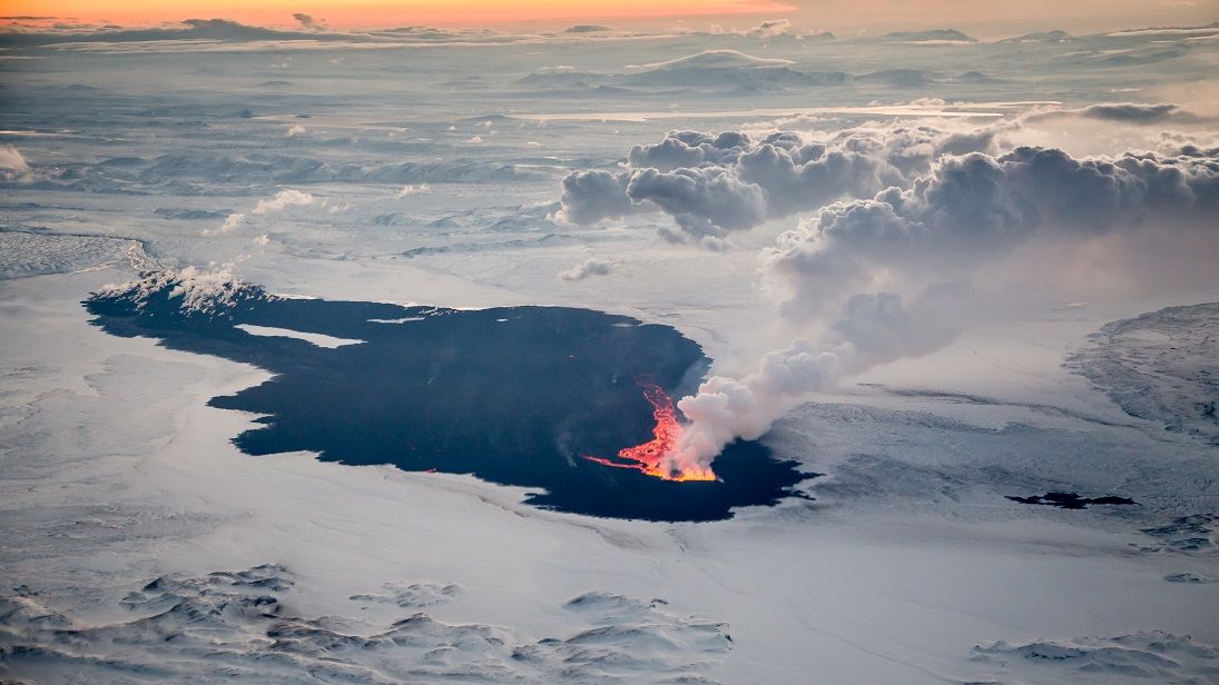
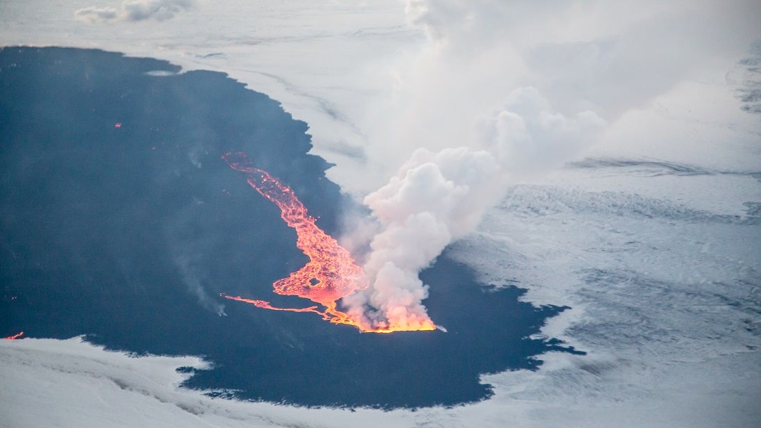
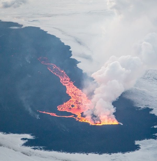
That's a huge freaking lake of lava! If we say it's merely 5% of the size of the flow it's still larger than Central Park. Of particular note is how the entire lava flow (Holuhraun? Þorbjargarhraun? Nornahraun? Flæðahraun? This naming dispute could go on for a long time...) is quite visibly still very hot (even areas that haven't flowed since the early days), to the point that snow can't collect on it. Lastly, the snow really helps the kīpuka in the middle stand out.
Speaking of Hawaiian terms and jumping briefly halfway around the world... lava is reportedly now only just dozens of meters from homes in Pahoa. At the rate it's flowing, it will reach them this evening. Officials are working to protect power poles with concrete insulated by scoria (the basaltic equivalent of pumice) and to create detours to keep road access open to residents.

Credit: Reuters / USGS
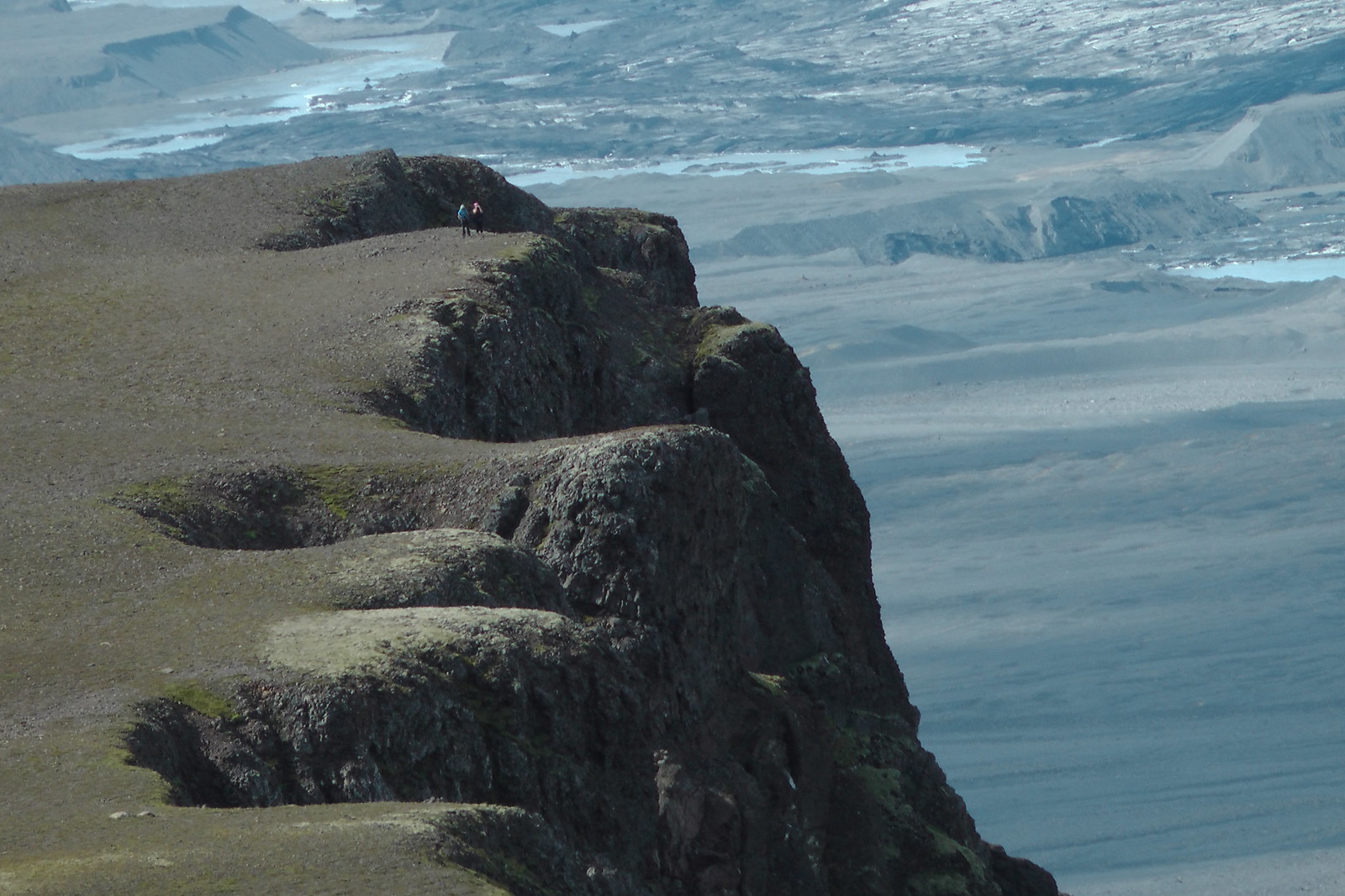
Back in the land of ice and fire, let's really take a look at the "ice" aspect, and what all of the fire is doing to it. First off, do you ever get a sinking feeling? Bárðarbunga sure does:
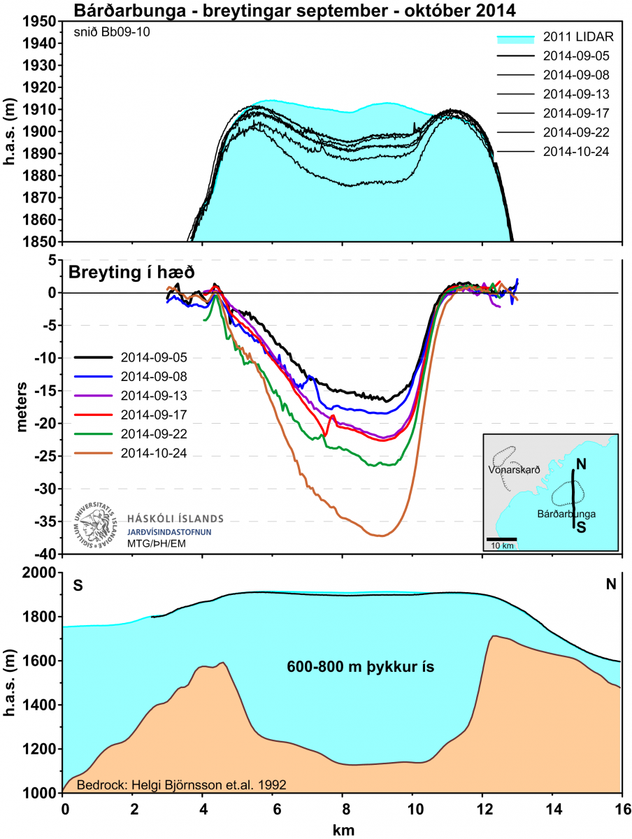
Credit: Jarðvísindastofnun
Not only is the cauldron continuing its steady drop, but this corresponds with a reported increase in geothermal activity. While the caldera itself has subsided 40 meters in two months, the ice cauldrons on the rim are subsiding even faster, up to 25 meters in one month. That's 80 centimeters (2 1/2 feet) per day.
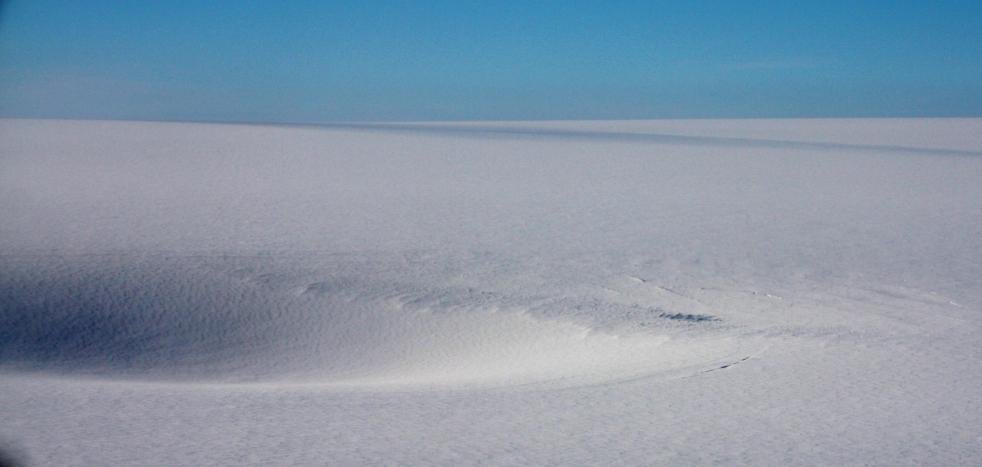
Can we see these ice cauldrons? Sure, here you go:
Credit: Þórdís Högnadóttir
Credit: Magnús Tumi Guðmundsson
Credit: Magnús Tumi Guðmundsson
They exist both on the west (right side of the picture) and southeast sides of the caldera (back/left side of the picture), with the southeastern ones growing twice as fast as the western ones.
Keep in mind the scale of what you're looking at. The plug in Bárðarbunga's caldera is the size of Manhattan; these depressions are massive. The subsidence now amounts to over a cubic kilometer. If your interest is in whether a caldera eruption is going to occur, these are the things to watch. Their melt rate is a direct indicator of how much heat is reaching the surface under the glacier. If we see a major increase in melt rates it could indicate that magma has gotten to just below the glacier.
Really, it's pretty remarkable that Bárðarbunga has been able to "keep her heat down" as much as she has so far despite the tremendous amount of seismic activity. But how long she can do that, and whether it'll be enough to ultimately prevent a caldera eruption, at this point nobody knows.
(There's no time for it this evening, so I'll write more on the global flow of the SO2 (which I had previously planned to do tonight) in my next update. :) )
Lastly, a treat for you all: possibly the best video of the eruption thusfar. My most interesting takeaway is that it looks like the river on the southern side has largely carved a straighter route, but there seems to be a lake with islands on the north side of the flow. If I'm understanding the position of the camera correctly.
