I’ve written about Table Mountain*, the local wildflower extravaganza that draws visitors north five hundred miles from SoCal. It is a glimpse of what spring in California offered before we European settlers improved it by blasting apart mountain slopes, draining wetlands, channeling rivers, developing agricultural lands, and slapping up buildings everywhere. Table Mountain, a massive basalt block above the Central Valley, survived these improvements. But I wonder if it can survive being protected.
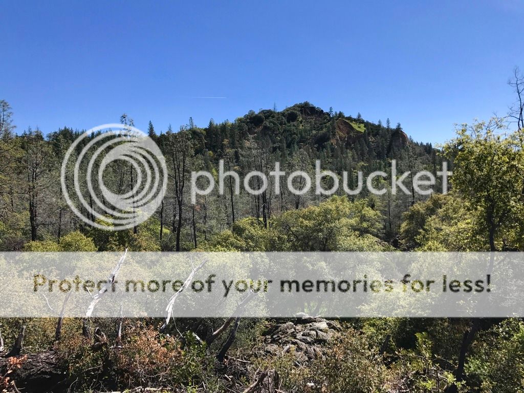
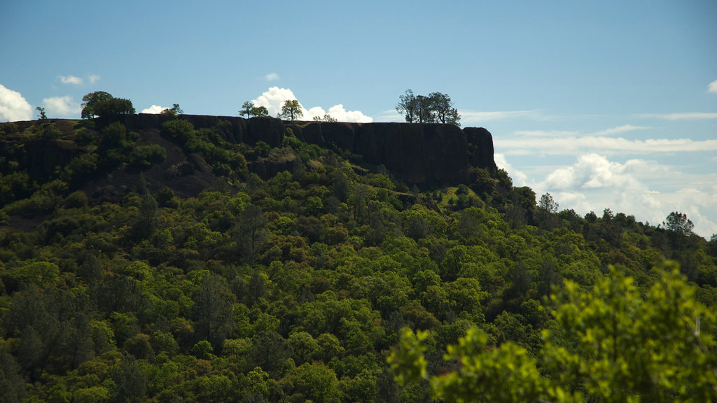 North Table Mountain (photo by Scott Jungling)
CDFW established an Ecological Reserve in the 1990’s to protect a portion of North Table Mountain habitat and to spare local ranchers the trespassers who broke fences and left gates open each spring. Long before it was an official tourist destination, I was a trespasser there (who respected fence integrity and never opened gates), back when most visitors were local residents. Now I ponder if fame and official status have done more harm than benefit — are tourists loving Table Mountain to pieces? Immigrants began dismantling the base of Table Mountain for gold almost 200 years ago. Are their ancestors now trampling it down from above to enjoy the wildflower show?
This is the minimum I expected when I visited in late March this year.
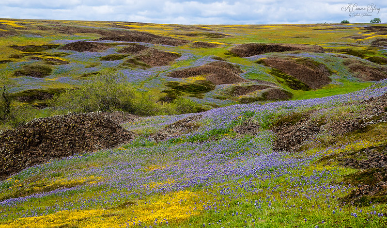 This photo is from 2014, the third year of catastrophic drought. The rock piles are naturally occurring basalt blocks. (photo by Sathish J)
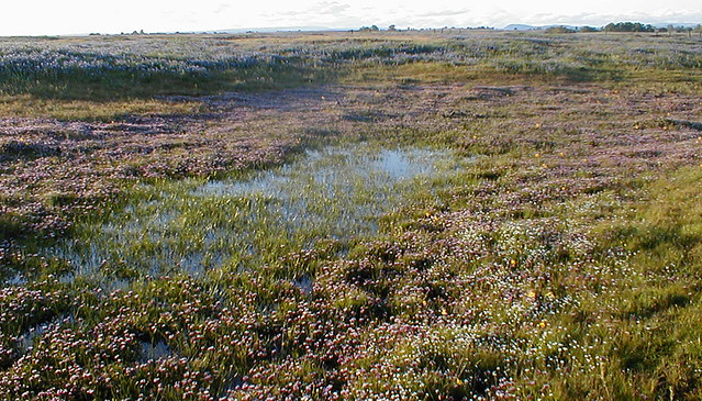
Here is what I saw this year — and I visited at the right time based on what was in bud, blooming, or what already had finished blooming and set seed.
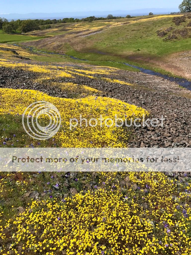 See the tiny flecks of purple with white dots? Those are the sky lupines that form fields of blue in the photo above. There were not more lupines that had already flowered, or yet tightly in bud in 2017. The yellow flowers are goldfields. That stream should be lined with vivid purple clover, bright yellow monkeyflower, and drifts of white meadow foam.
The disappointing bloom wasn’t due to inadequate rainfall. Northern California had a record-setting amount of rain this season. Ephemeral waterfalls spilled off Table Mountain’s eroded basalt slopes.
 Coal Canyon Phantom Falls 2017. (photo by Lisa Ouellette)
Pockets of lush vivid blooms scattered on slopes a 30 minute hike from the parking area, thrilling naive visitors. But these pockets were small compared to 25 years ago.
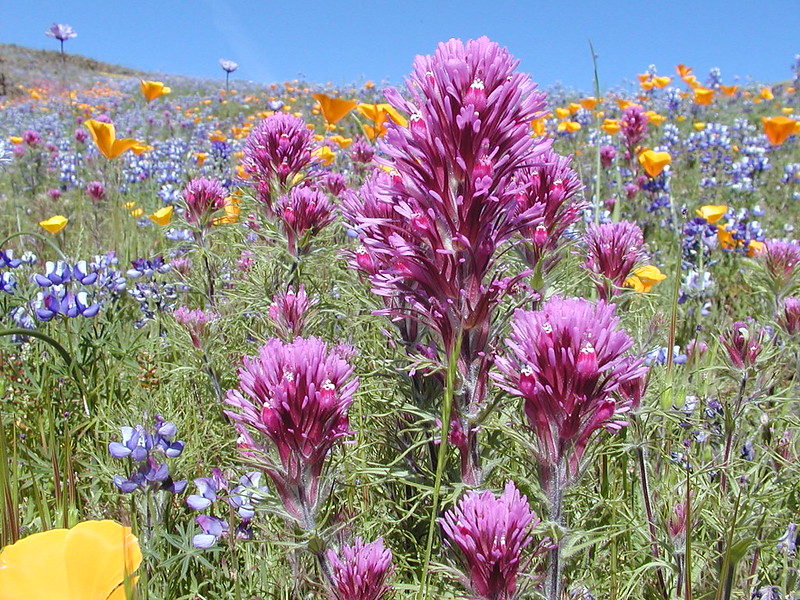 Golden California poppies, purple owl’s clover, and sky lupines in 2005. (Photo by CDFW)
The pockets of bloom weren’t vernal pools. This is what a fairly healthy vernal pool habitat looks like.
 In April 2005, the vernal pools were lush with flowers.
**Note the dark mountain barely showing on the horizon right of the center. ** (photo by mary)
This year, some vernal pools on the flat area adjacent to the road had plant species I expected but fewer in number and sadly reduced in diversity. Some pools stunned me with their sparse vegetation.
 March 2017 after the wettest winter ever recorded. The darker grey rocky area in the center and the foreground rocks should be flooded. This is roughly the same area as the photo above but I’m not crouched down so low to the ground while taking the photo.
**See the mountain on the horizon that is the same one in the photo above?**
Even during the drought, in 2015 decent vernal pools persisted across the road from the Reserve where tourists aren’t allowed. The pools weren’t as full of water as in 2005. The bands of color result from variations in water depth and inundation duration because of how different plant species tolerate flooding.
 In this pool, the white is the lower (wetter) areas of coyote thistle. Yellow is more upland goldfields and tidy-tips and furthest upland is the green grass.
I don’t know why this season’s wildflowers weren’t spectacular. Table Mountain’s floral abundance and diversity has steadily decreased since the 1990’s. Perhaps too many tourists have stomped across the table top portion compacting the soils and disturbing the vernal pool hydrology? There are no defined paths except cow trails, no boardwalks, no restrictions on how people use the area. The parking lot holds at least three times the number of vehicles compared to the original road edge parking (that is also still used). School buses haul in classrooms of local students. CDFW works with ranchers to manage cattle to preferentially browse on non-native grasses at the proper time that benefits native plants. I can’t blame the cows for this year’s crappy show.
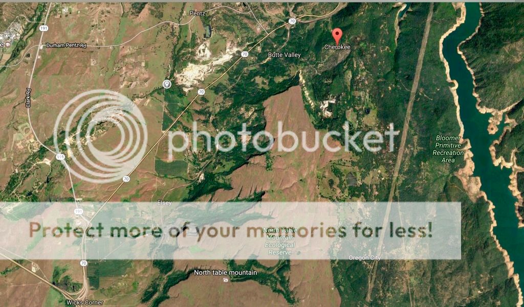 Table Mountain Ecological Reserve is the brown center area. The ravines below the steep basalt cliffs with ephemeral waterfalls are the green areas snaking in on the west (left). The water on the far right is the portion of Lake Oroville that flooded the West Fork Feather River. Out of the map in the lower right is the Oroville spillway that was the cause of this winter’s near disaster. The brown straight line from upper to lower right are transmission lines from the hydro-electric power plants in the Feather River Canyon.
I walked back across the flat rocky table to my car, feeling homesick. Worse than homesick since I hadn’t left home. My wildflower home had left me. I drove away, winding past marshes, creeks, pastures, and occasional farm houses along Cherokee Road. Then I remembered the old cemetery I’d passed on the drive to Table Mountain. Cherokee Cemetery suited my mood. I already had my Goth on.
|
The Daily Bucket is a nature refuge. We amicably discuss animals, weather, climate, soil, plants, waters and note life’s patterns spinning around us.
We invite you to note what you are seeing around you in your own part of the world, and to share your observations in the comments below.
|
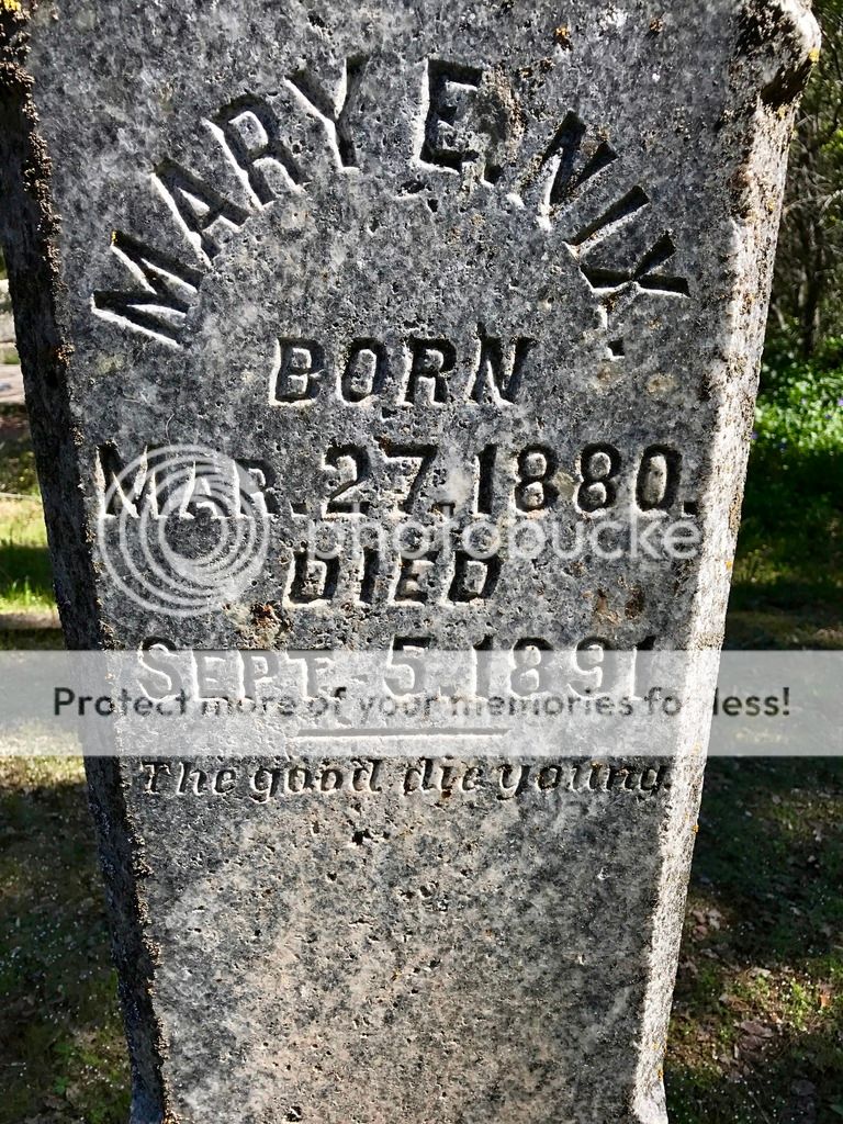
 The memorial stone at the entrance to Cherokee Cemetery was erected about a century after the first body was buried.
The earliest Europeans in the Cherokee area reportedly were Spanish explorers from Mexico who found gold at the base of Table Mountain in 1818. They were the first to dig up and carry away pieces of the mountain. Then in the early 1850’s, the slopes began collecting immigrants from the east as miners raced into the foothills seeking gold.
These miners found Cherokee Indians here already panning for gold. The local indigenous Indians were Maidu and although it isn’t disputed that the Cherokee were here, no one is certain how this happened. One story is that S.O. Potter, of Maine, a teacher on a reservation in Oklahoma, caught gold fever and brought some of his students with him. I believe someone named Potter was here as Potter’s Ravine still exists on the east side of Table Mountain along what was once the West Fork of the Feather River (now flooded by Lake Oroville).
Welsh miners, migrating from England in 1853, built stores, perfected mining techniques, and named the town for the industrious Native Americans who had preceded them. The Cherokee diggins were rich -- very rich. Electrified mines (Thomas Edison was one of the owners) allowed 24-hour operation year round, and miners' wages were high for those times -- $3 per day . . . The county's first running water was in homes here.
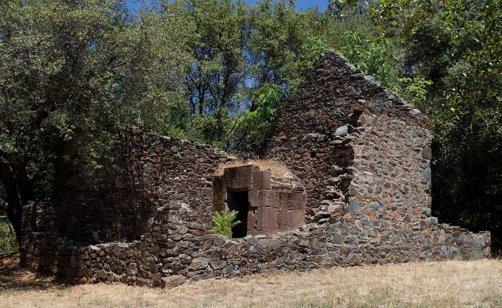
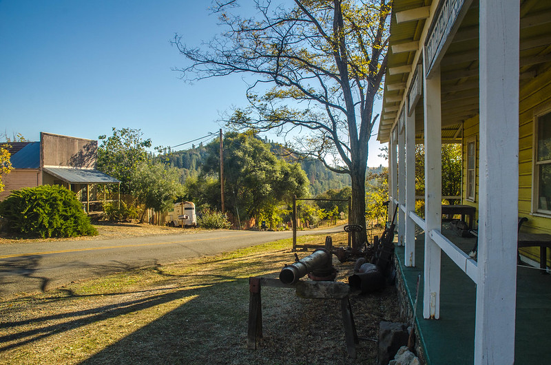 Some of the old buildings in Cherokee with Table Mountain in the background. (Photo by Wayne Hsieh)
By 1854 Cherokee was a town with a post office and a stamp mill that pounded quartz to extract gold
. Also in the 1850’s, a cemetery was established. It is still used to bury local residents beside the graves of settlers
who built and operated the largest hydraulic mine in the U.S. At one time 40 million gallons of water blasted the sides of Table Mountain every day. After the gold and other valuables was extracted, the soil and water flowed down into the valley below.
In the late 1860s, small mining operations began to merge to form Cherokee’s first mining companies, which grew and folded further into a few large, major players. With expanded capital enabled by these consolidations and the attraction of investors, the first of many ditches, flumes and pipes began carrying water into Cherokee from farther up in the Sierra Nevada mountains. This system was expanded over the next decade to include more than 100 miles of waterways conducting water from reservoirs, the largest of which was a 300-acre man-made lake at Concow.
Between 1870 and 1894, Cherokee’s hydraulic-mining operation . . . was regarded as a technological marvel. Using gravity and a series of pipes that gradually grew smaller, the water was channeled through 18 huge water cannons . . . that spewed water at pressures high enough to shoot 400 feet. [They] blasted away at Cherokee’s proximate peak, washing tons of rock and gravel down shafts through the humongous Eureka Tunnel [carved out of bedrock] and over nine miles of industrial-sized sluice boxes. Dynamite helped rip loose more stubborn rock faces, and water-powered derricks moved boulders weighing several tons.
 Mountain side blasted away by water cannons.
Cherokee’s wealth, however, wasn’t due only to gold. In
June 1861 diamonds were discovered; the first diamonds found in the U.S.
At it’s peak, Cherokee had over 1,000 people with 300 miners working three shifts around the clock thanks to Edison’s electric lights. There were
17 saloons, eight hotels, two churches, two schools, theater, racetrack and brewer. But in 1890’s, problems with lawsuits for crop damage from all the rock, mud, and water the mines washed down into the valley agricultural land below and increasing costs of operating the hydraulic mines signaled the end of this era. In 1894, Cherokee large-scale mines were finished after extracting $15 million in gold (at 1890’s values), 400 diamonds, and some platinum.
 The temporarily rich miners needed Cherokee bank and the strong vault that still remains. (Photo by Don Barnett)
Names of many who lived in Cherokee remain on gravestones, towns, land features, portions of the river, and roads. As with the town buildings and the mines, some of their gravestones are barely visible now.
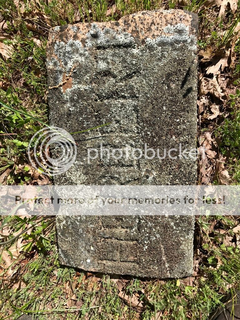 This might be the final resting place of Herbert. It’s becoming part of Cherokee Cemetery’s landscape now and lichen is slowly turning the stone into soil.
 Mecilla’s family didn’t plant that vinca growing around her gravestone. It’s a modern introduction.
White marble for the gravestones in Cherokee Cemetery came from Italy and the blocks were used as ballast in sailing ships.
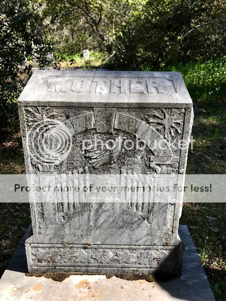 The older gravestones have elaborate carvings. Some of the newer stones have colored photos of the graves’ occupants (several with Hmong names) embedded in the top. I didn’t photo those. It seemed rude.
In the cemetery a common California wildflower sprawled amidst the lilacs, spirea, and vinca.
 Indian paintbrush (Castilleja affinis) is one of the few Indians still living in Cherokee.
 That message comforts the grieving who are, presumably, older? And not-so-good?
At the far end of the cemetery, big old black oaks shelter long dead miners and their families. By the time I had walked through the cemetery reading the gravestones, I’d looked back over a 150 years and pondered messages from the past such as the one in the photo above. I’d noted the matching stones of families’ children buried within a week or two of each other. Rows of Morgans (see the lead image), some of the miners who came from Wales and built the original town of Cherokee in the early 1850’s, filled one section.
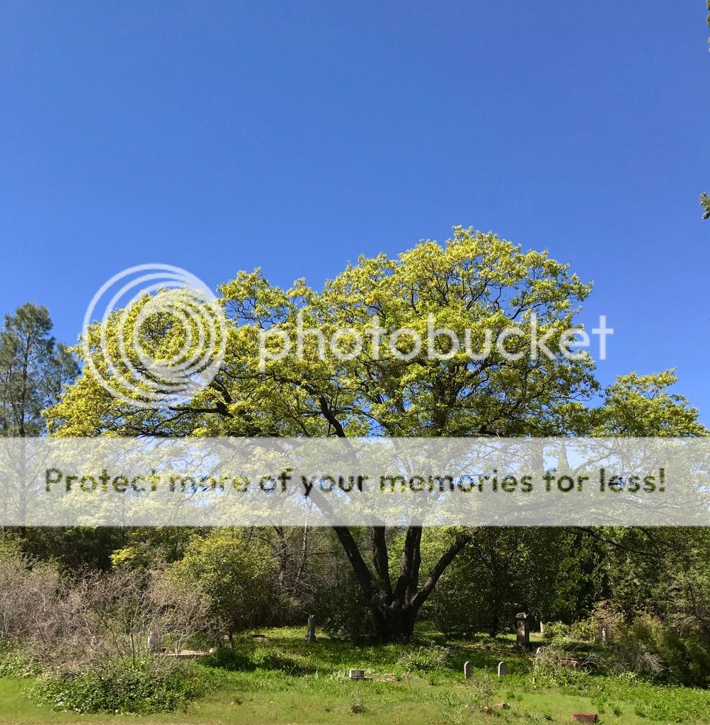 The oldest section of the cemetery under a big black oak.
The town of a thousand people who traveled across an ocean and a continent to reshape Table Mountain now holds about twenty residents. But the vernal pool and wildflower fields, formerly territory of the local Maidu who left only grinding stones, now host several thousand visitors in two months of each year, many traveling from hundreds of miles away.
We aren’t blasting Table Mountain with water cannons any more. In the Reserve, we only take photos, although there is a quarry at the mountain’s northwest foot and Lake Oroville floods some of the eastern slope along the Feather River. Now are we aren’t leaving much behind besides footprints. But what a big footprint we collective humans have these days.
 Two women prove they visited Table Mountain in April 2015. Do they realize what is missing? (photo by Mitch Lorens)
* I’ve previously written about Table Mountain, describing how it formed at least 15 million years ago from a basalt flow. Photos in these previous stories show the glorious wildflowers that I had expected to see this year. This year catalyzed my suspicions that all is not well with the vernal pools on Table Mountain.
|
SPOTLIGHT ON GREEN NEWS & VIEWS POSTS EVERY SATURDAY AND WEDNESDAY AFTERNOONS (PACIFIC TIME) ON THE DAILY KOS FRONT PAGE. BE SURE TO LOOK FOR THE STORIES YOU MISSED. RECOMMEND AND COMMENT TO THANK METEOR BLADES FOR HIS DEDICATED CURATION.
|
Show off your wildflowers.
Represent your Goth side.
(I’ll be along around 9am or so. I set this to publish early.)


