Since there are some people who seem to want another EPIC Glacier National Park meetup, this is the official call for such an event. The most important thing to decide in the near future is when and where.
![0013 photo DSCN0013_zpsda51a39a.jpg](http://i821.photobucket.com/albums/zz139/Ojibwa/Glacier%202013/Logan%20Pass/DSCN0013_zpsda51a39a.jpg)
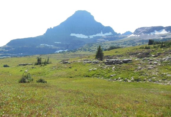
Logan Pass in August is shown above.
When:
At this point, we have talked about two possible date: one in June and one in September. Some things to keep in mind: July and August is the peak season in the park and it tends to be a bit crowded.
The major attraction in the park is the engineering marvel known as the Going-to-the-Sun Road which crosses the Rocky Mountains (The Backbone of the Continent in Blackfoot terminology). Logan Pass at the top of the Road tends to get lots of snow during the winter and cannot be opened for travel until plowing is complete. Sometimes this has been as late as July. The earliest the Going-to-the-Sun Road could be accessible for its entire length is June 19, 2015. The road will close on September 21, 2015, between Logan Pass and near St. Mary Campground. With this in mind, possible weekend (Friday/Saturday/Sunday) dates are:
June 26, 27, 28
July 3, 4, 5 (Note: this may be a bit crowded, but the free shuttles over the pass will be running)
September 4,5,6 (Note: this is Labor Day weekend and the Park may still be crowded. The shuttles will be running)
September 11, 12, 13
September 18, 19, 21
Where:
There are really two basic Glacier Parks for most tourists: West and East. The West side begins at the West Glacier entrance and includes the village of Apgar and Lake McDonald. The East side includes the St. Mary area, the Two Medicine area, and the Many Glacier area. For those traveling by air or train, the West side is more convenient.
![photo DSCN3207_zps2acb707e.jpg](http://i821.photobucket.com/albums/zz139/Ojibwa/Glacier%202014/April%20Apgar/DSCN3207_zps2acb707e.jpg)
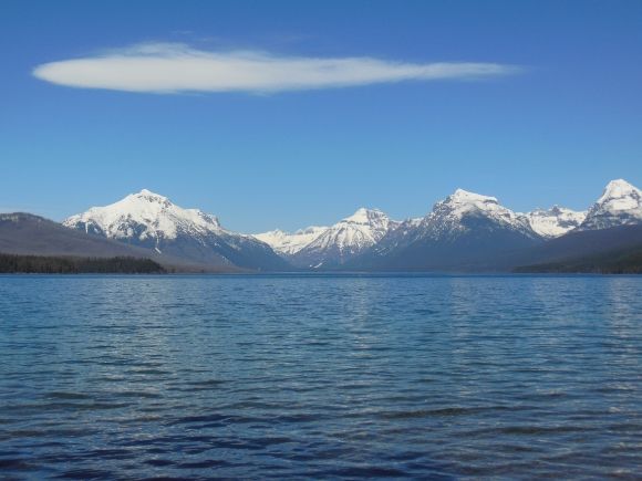
Apgar area on the West side is shown above.
![photo DSCN2273_zps1704f047.jpg](http://i821.photobucket.com/albums/zz139/Ojibwa/Glacier%202014/Sun%20Road%20July/DSCN2273_zps1704f047.jpg)
![photo DSCN2268_zps635654cd.jpg](http://i821.photobucket.com/albums/zz139/Ojibwa/Glacier%202014/Sun%20Road%20July/DSCN2268_zps635654cd.jpg)
![photo DSCN2243_zpsf82d915c.jpg](http://i821.photobucket.com/albums/zz139/Ojibwa/Glacier%202014/Sun%20Road%20July/DSCN2243_zpsf82d915c.jpg)
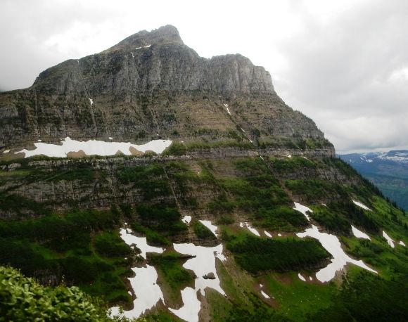
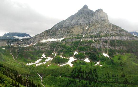
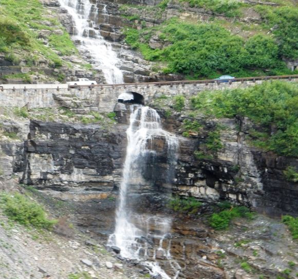
Going-to-the-Sun Road on the West side is shown above.
![photo DSCN3832_zps304992e5.jpg](http://i821.photobucket.com/albums/zz139/Ojibwa/Glacier%202014/Lake%20McD%20Lodge/DSCN3832_zps304992e5.jpg)
![photo DSCN3854_zps6a9c7d5a.jpg](http://i821.photobucket.com/albums/zz139/Ojibwa/Glacier%202014/Lake%20McD%20Lodge/DSCN3854_zps6a9c7d5a.jpg)
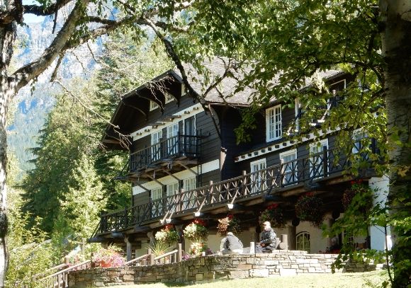
Above is the Lake McDonald Lodge on the West side.
![photo DSCN3621_zps6a084166.jpg](http://i821.photobucket.com/albums/zz139/Ojibwa/Glacier%202014/MG%20Hotel/DSCN3621_zps6a084166.jpg)
![photo DSCN3547_zps6b8a71ed.jpg](http://i821.photobucket.com/albums/zz139/Ojibwa/Glacier%202014/MG%20Hotel/DSCN3547_zps6b8a71ed.jpg)
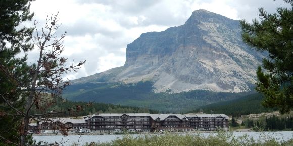
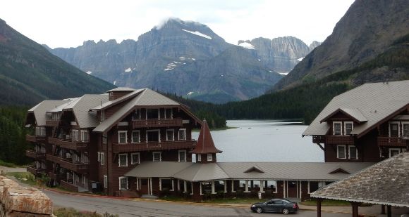
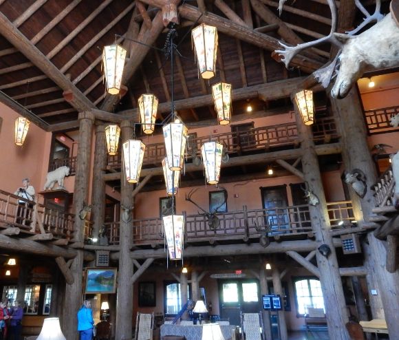
Many Glacier Hotel on the East side is shown above.
![photo DSCN3570_zps926ab88b.jpg](http://i821.photobucket.com/albums/zz139/Ojibwa/Glacier%202014/MG%20Mountains%20Glaciers/DSCN3570_zps926ab88b.jpg)
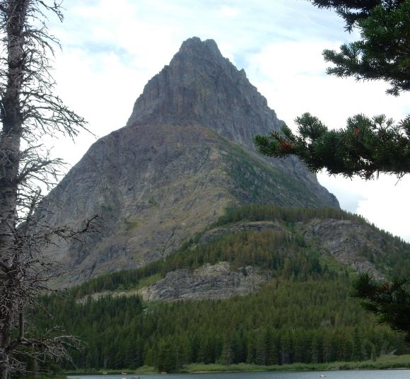
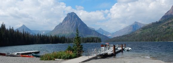
The Many Glacier area on the East side is shown above.
![photo DSCN3585_zpsc2ed5104.jpg](http://i821.photobucket.com/albums/zz139/Ojibwa/Glacier%202014/Swift%20Trail/DSCN3585_zpsc2ed5104.jpg)
Moose on the East side.
![photo DSCN3582_zps127958cd.jpg](http://i821.photobucket.com/albums/zz139/Ojibwa/Glacier%202014/Swift%20Trail/DSCN3582_zps127958cd.jpg)
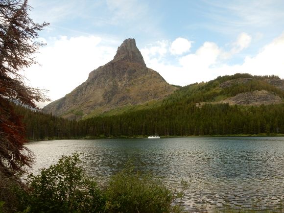
Many Glacier area on the East side.
![photo DSCN3509_zps3bc30380.jpg](http://i821.photobucket.com/albums/zz139/Ojibwa/Glacier%202014/Two%20Medicine/DSCN3509_zps3bc30380.jpg)
Two Medicine on the East side is shown above.
![Lake 3753 photo DSCN3753.jpg](http://i821.photobucket.com/albums/zz139/Ojibwa/Glacier%202012/St%20Mary/DSCN3753.jpg)
![Little Falls 3737 photo DSCN3737.jpg](http://i821.photobucket.com/albums/zz139/Ojibwa/Glacier%202012/St%20Mary/DSCN3737.jpg)
![Falls 3724 photo DSCN3724.jpg](http://i821.photobucket.com/albums/zz139/Ojibwa/Glacier%202012/St%20Mary/DSCN3724.jpg)
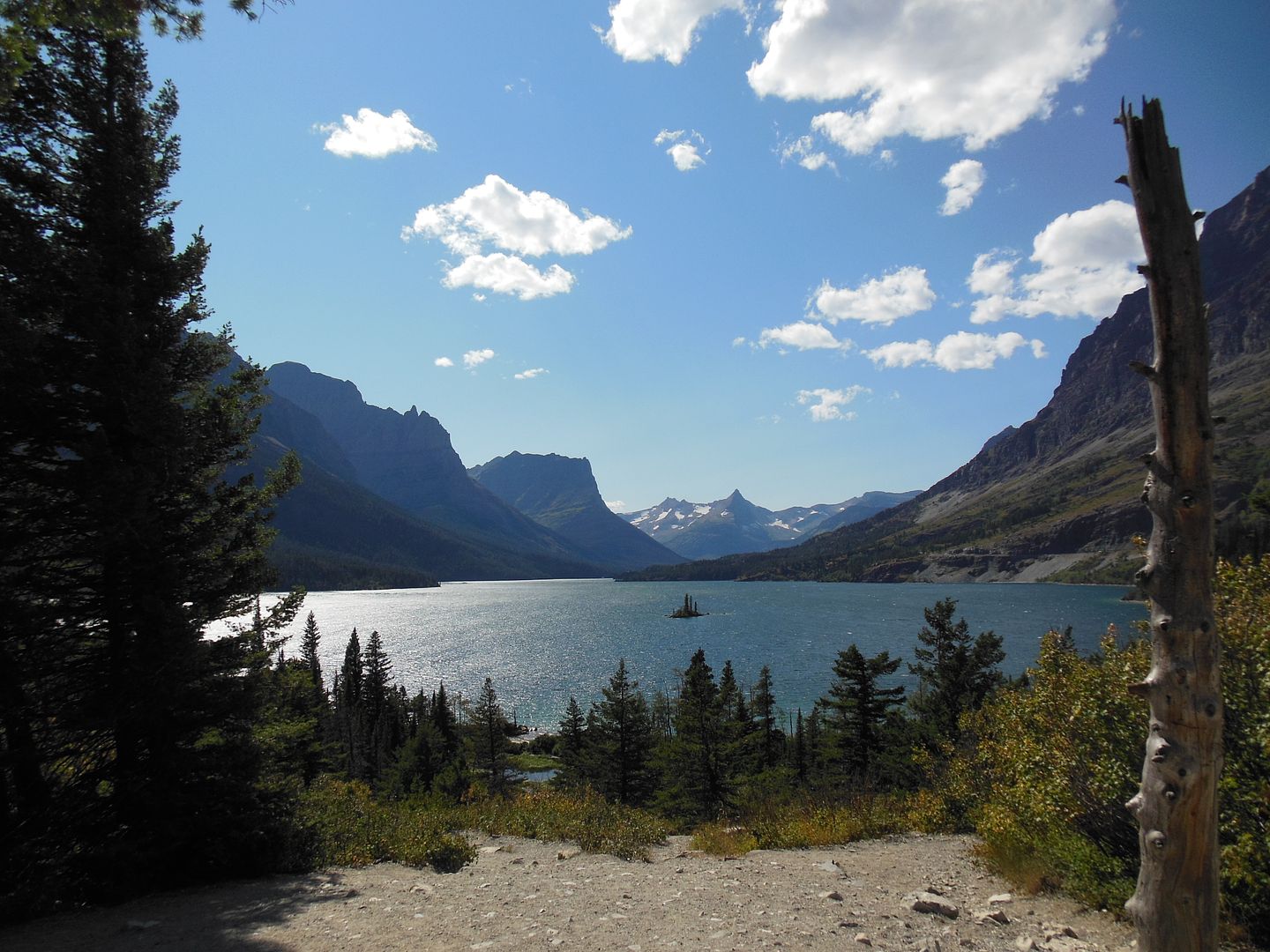
St. Mary Lake area, East side is shown above.
![9050 photo DSCN9050_zpsd9a3e9fe.jpg](http://i821.photobucket.com/albums/zz139/Ojibwa/Glacier%202013/Kintla%202013/DSCN9050_zpsd9a3e9fe.jpg)
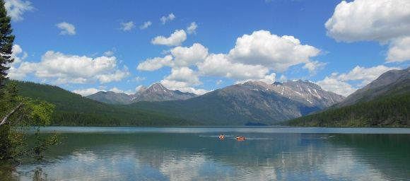
Shown above is Kintla Lake, off the tourist track on the West side.
In the comments below, please indicate your preferences for when and where you would like the meetup.
![WG 3127 photo DSCN3127.jpg](http://i821.photobucket.com/albums/zz139/Ojibwa/Glacier%202012/West%20Glacier%20Aug%202012/DSCN3127.jpg)
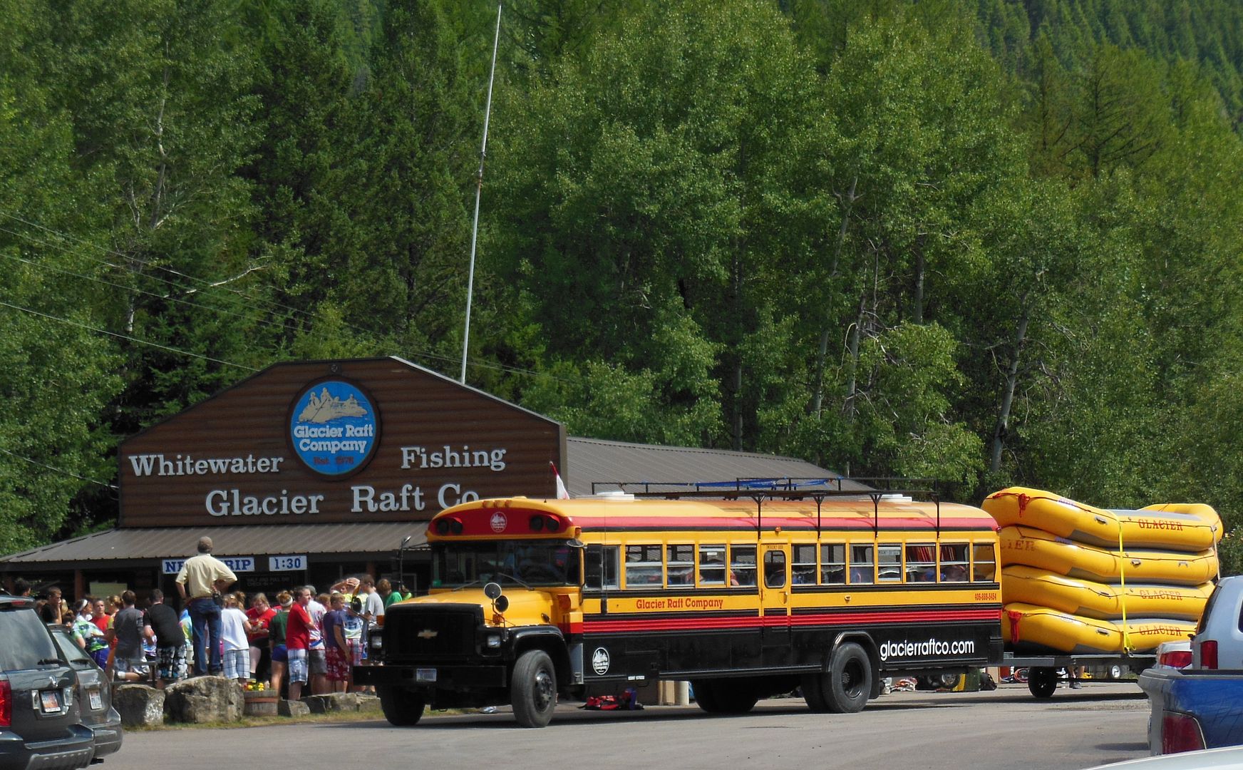
Rafting is a possible activity on the West side.