 No politics today. I spent the weekend in Sequoia National Park (SEKI to the National Park Service), had adventures, took pix, came home, blogged about it.
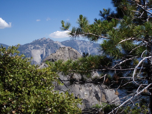
Sequoia is a huge park, but the NPS has chosen to focus visitor activities on one charismatic megaflora: the General Sherman tree. People ride shuttle buses to see one tree, turn around, shrug, say If you've seen one redwood, you've seen 'em all, and ride the shuttle bus back to their cars. Maybe they also ride another shuttle to take the half-mile hike up Moro Rock for the view. I've seen that tree and that view. I want to touch the sky above the trees.
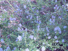 I don't understand the logic of waiting in line for buses to take people from the Giant Forest Museum to Moro Rock, 2 road miles away. Very few of them consider walking through the Giant Forest instead. The rolling hills make for easy hiking. Patches of ceanothus like blue clouds surround me,
flowering dogwood makes me smile, 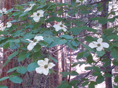
and scarred old veterans demand my respect. 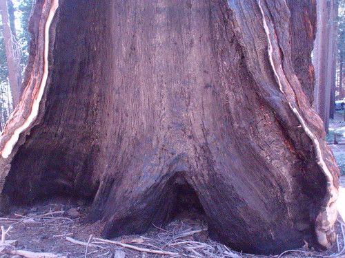
Moro Rock is far too crowded for my tastes, so I elect a journey of solitude in the park's isolated corner, Mineral King, for the next day's hike.
If desireable = hard to get, Mineral King must be one of the most desireable places on earth. First, the Dramamine Road: 25 miles of badly maintained single-lane road, each hairpin turn giving you the opportunity to replay the final scene of Thelma & Louise, 90 minutes minimum. Then the car-eating marmots. You may scoff at them as an urban legend, but this legend shows up on camera. 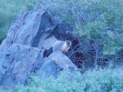
" There are no easy trails out of Mineral King," warns the otherwise optimistic map. I choose a lightly traveled path to Farewell Gap, at the boundary between Mineral King and the next valley over, outside the park boundaries. I want to touch the sky at the edge of the earth.
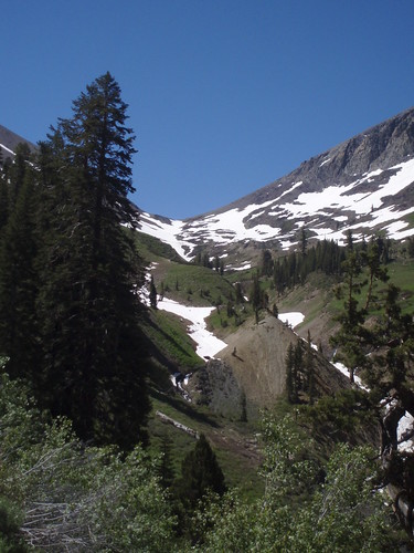
Two creeks must be forded. The guidebook describes them as boulder-hopping crossings, but during this season of abnormally high water, they have to be waded, knee deep in swiftly moving snowmelt. Then the trail heads up. And up. And up. Snow level is at 9,000 feet today, and my destination is 10,500 feet. My path traverses several snowfields along with easily forded rivulet-waterfalls.
Then I pause at a waterfall. 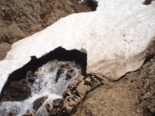 The water is too wide to be forded, too swift to be waded, too steep to be crossed above or below. A hollow snow bridge provides the only route. Snowmelt rushes underneath the rapidly melting bridge. If the bridge can't bear my weight, I'll fall into the boulder-strewn waterfall. Lots of bad endings start from that: broken ankle, fractured skull, hundreds of feet down. I start across. I slip, nearly to the edge of the snow bridge. I make it across, but my confidence is badly shaken.
Shortly after that, I get a good glimpse of Farewell Gap. 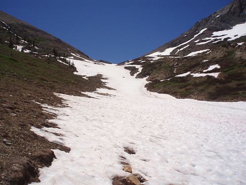 It's completely snow-covered. If I continue, I'll be traversing more snowfields, hunting for a trail, and one false move will send me into the snow-covered river headwaters. Reluctantly, I decide that Farewell Gap will wait another day. I haven't touched the sky at the edge of the world, but I've found beauty, joy, and utter solitude. I retrace my steps, once again slipping on the snow bridge, once again my life flashing before my eyes. At the Farewell Gap-Franklin Lakes junction, I decide to detour to a slightly more popular route.
Franklin Lake is a common or garden variety drop dead gorgeous glacial cirque of a lake (albeit with an early 20th century dam). Here, colors are reduced to the most essential: gray granite, white snow, teal water, and the most perfect summer-sky blue of the known universe. If I can't touch the sky, I can hear it in the howl of coyotes. 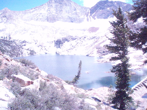
I retrace my steps with one last look at Farewell Gap, some of my switchbacks visible in the distance. 
As a final grace note to my day in Mineral King, a bear ambles across the road down.
