I see little mention of this phenomenon in many of the diaries here, (although I know it is common knowledge amongst our expert diarists, including FishOutofWater who has posted an excellent diary) but that is one of the main reasons why the low pressure of a hurricane is so dangerous: the low atmospheric air pressure of the storm is physically lifting the level of the ocean beneath it. This is in addition to the added heights of wind driven waves and precipitation in the air, etc...
From NOAA's website:
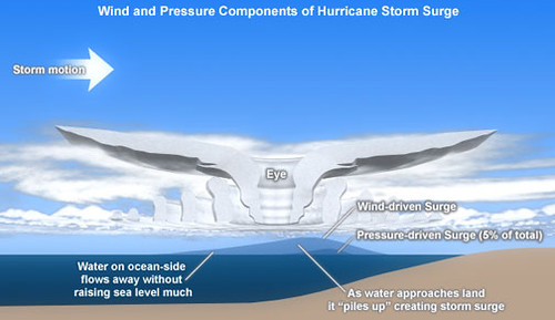
Highlighted by me:

That's 5% additional water height. So for a 20 ft storm surge 1 entire foot is from atmospheric uplift alone!
Add to all that just the right kind of topography as Rhode Island's Narragansett Bay
did for the 1938 storm:
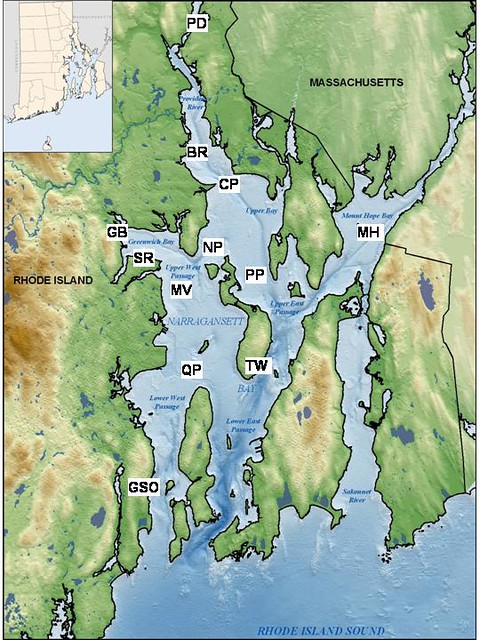
Providence is the PD at the top of the map. The top of what is effectively a giant funnel.
and you get:

Downtown Providence 1938
Downtown Manhattan 2012
Oh yeah, Did I mention it's a full moon?
