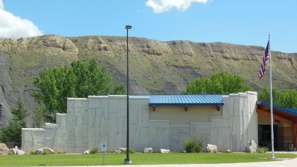
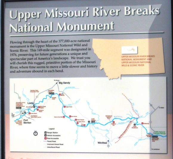
The Upper Missouri River Breaks National Monument covers about 375,000 acres of public lands in central Montana administered by the Bureau of Land Management (BLM). Flowing through the monument is the 149-mile Upper Missouri National Wild and Scenic River. The Missouri Breaks Interpretive Center is located in Fort Benton, Montana. The center provides displays on the human history and wildlife of the area.
One of the frequent questions visitors ask is: “What does ‘Breaks” mean in the Upper Missouri River Breaks?” According to the Center’s website:
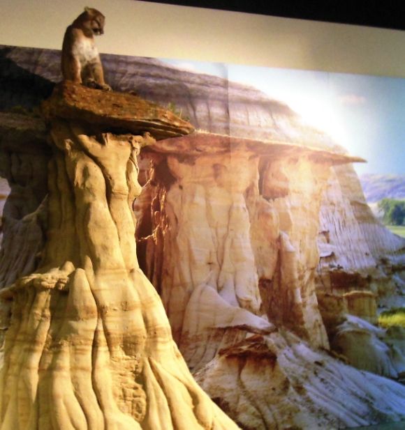
The Breaks is a local geographic term describing the rugged valleys, badlands, bluffs, and coulees surrounding the upper Missouri River areas. It is often said that it appears that the land breaks away to the river. Others have described this terrain as upside-down mountains or badlands though the breaks is the most common term used to describe this area.
In 1976, Congress designated a 149-mile stretch of the Missouri River through northcentral Montana as wild and scenic. In 2001, President Clinton established the Upper Missouri River Breaks National Monument.
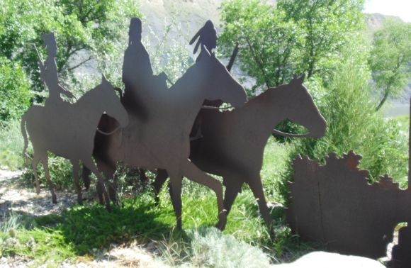
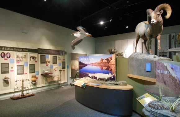
Photographs of the displays at the interpretive center are shown below.
History:
This region was the home to many Native American nations—the Blackfoot, Gros Ventre, Assiniboine, and Crow—for thousands of years. Other tribes, such as the Shoshone, Cheyenne, Sioux, and Nez Perce often travelled through the area. In the early nineteenth century, the American Corps of Discovery under the leadership of Meriwether Lewis and William Clark travelled through the area. Then came the fur traders and trappers who established a number of trading posts along the river. The last of these trading posts was Fort Benton, established in 1847.
In 1860, the first steamboat reached Fort Benton and brought in a new era for the area.
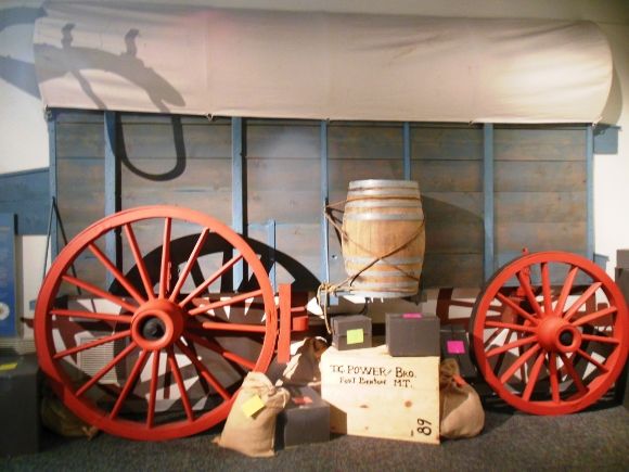
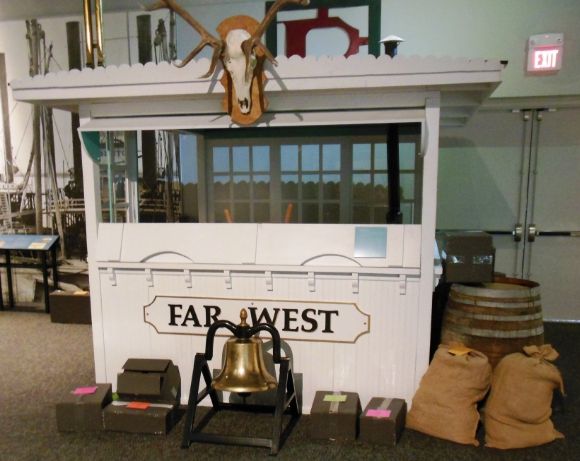
Shown above is the display showing a Murphy wagon and what it could carry. These wagons were loaded with 2.5 to 3 tons of freight and were coupled in tandems of three. Eight to ten yoke of oxen were hitched to the wagons or large multe teams were used for a faster pace. The wagons would average 8 to 10 miles per day. All of the boxes are labeled showing contents and weight.
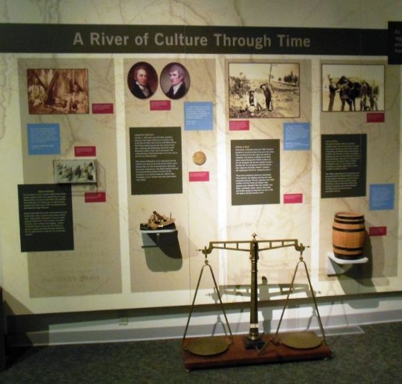
The River of Culture through Time display begins with Native Americans and includes a photograph of the Blackfoot by Edward Curtis. It also talks about the Corps of Discovery (Lewis and Clark), and the river freighting era.
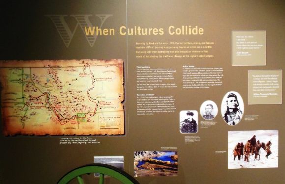
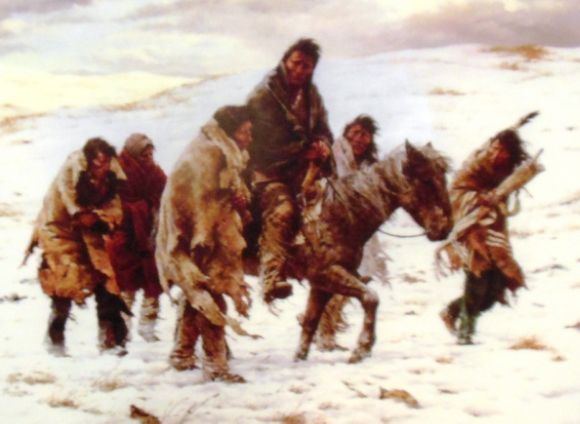
In 1877, the non-treaty Nez Perce fled from the U.S. Army. They crossed the Upper Missouri at Cow Island, about 126 miles downstream from Fort Benton. At the Bear Paw, they surrendered. The surrender of Nez Perce Chief Joseph is shown above.
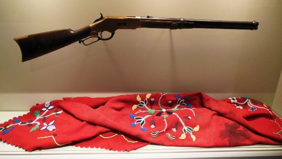
Chief Joseph’s rifle is shown above.
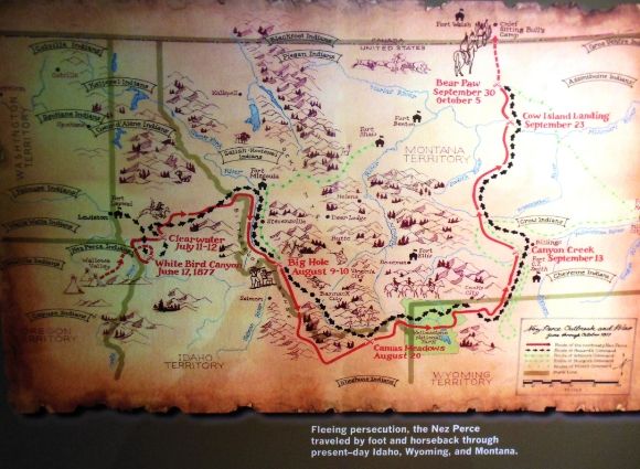
A map depicting the 1877 Nez Perce War is shown above.
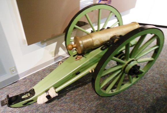
A mountain howitzer is shown above. This howitzer was one of two that was used in the 1877 Nez Perce War.
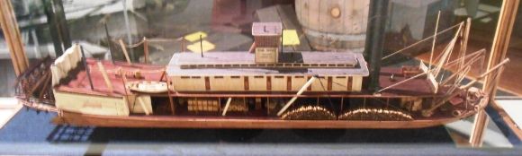
Shown above is a model of a Missouri River steamboat. The earlier human-powered keelboats might take as long as five months to make the 3,000 mile trip from St. Louis to Fort Benton. Steamboats made the trip in a month or less. The first steamboat to come up the Missouri was the American Fur Company’s Yellow Stone in 1832. In 1860, the steamboats Chippewa and Key West reached Fort Benton making it the world’s innermost port.
Wildlife:
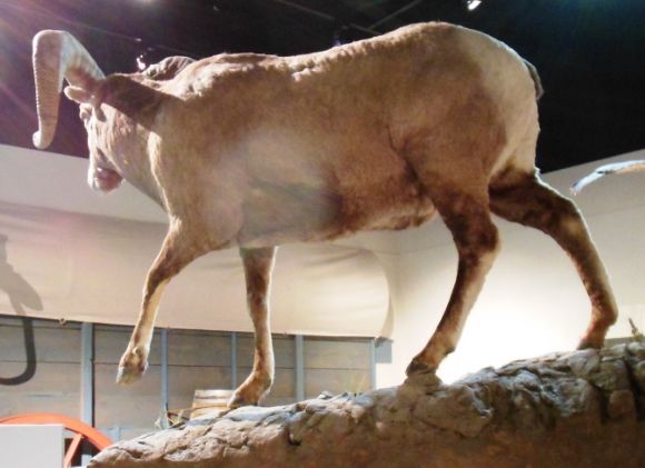
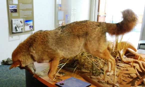
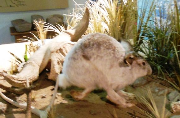
The Upper Missouri River Breaks region is home to many different animals. The center’s displays show a number of these animals and offer visitors an opportunity to touch them and to hear their calls.
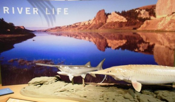
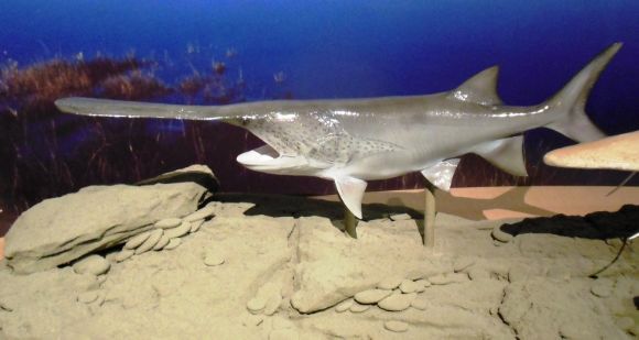
Shown above is a pallid sturgeon which is an endangered species.
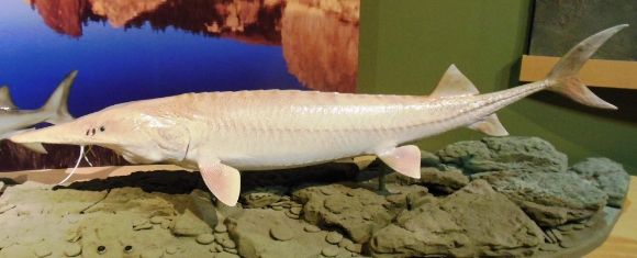
Shown above is a paddlefish. Both the pallid sturgeon and the paddlefish can live to be 60 years old.
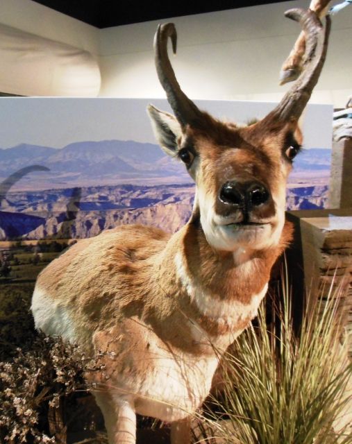
Shown above is a pronghorn. While it is often called an antelope, it really isn’t: it is a species of artiodactyls mammal. The Corps of Discovery under the leadership of Meriwether Lewis and William Clark were the first non-Indians to bring this animal to scientific notice.
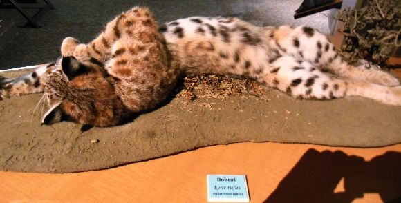
The bobcat shown above is playing with some feathers in a bush.
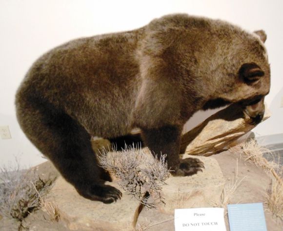
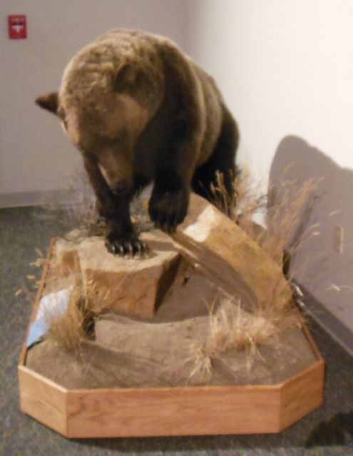
Unlike the other animals in the display, visitors are not allowed to touch the grizzly bear.
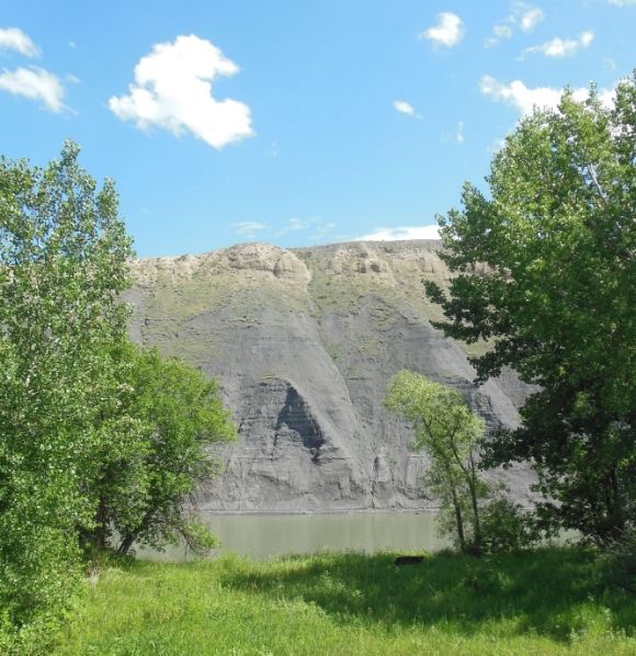
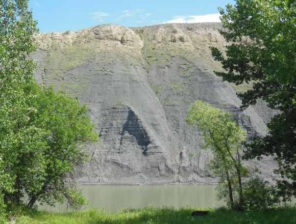
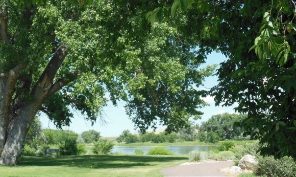
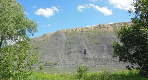
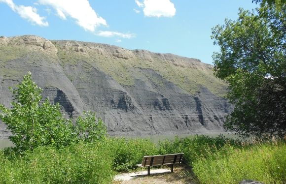
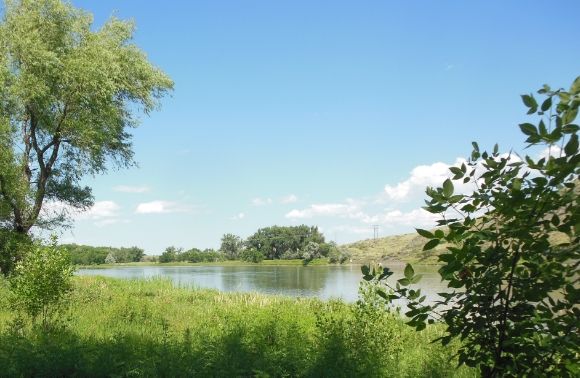
The River:
Shown below are photographs of the Missouri River in front of the center.