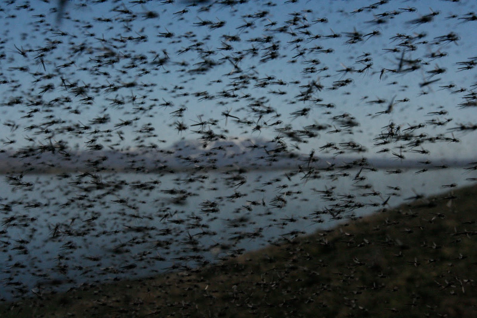
If there's any place in Iceland that speaks to the sensitivity of nature to change, it's Mývatn. It's a protected area, rich not just in unusual geology but wildlife. The mineral content of the lake nurtures large blooms of terrifying gigantic mosquitoes:
(Credit: University of Wisconsin - Madison)
Lots of mosquitoes:
(Credit: University of Wisconsin - Madison)
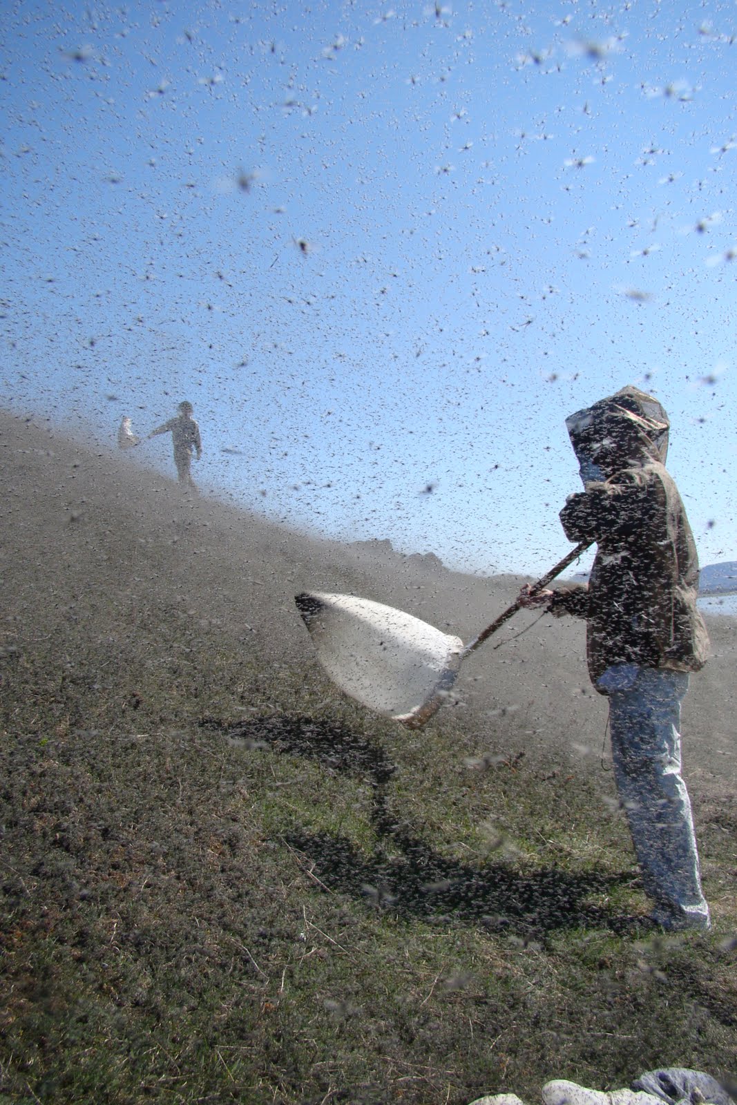
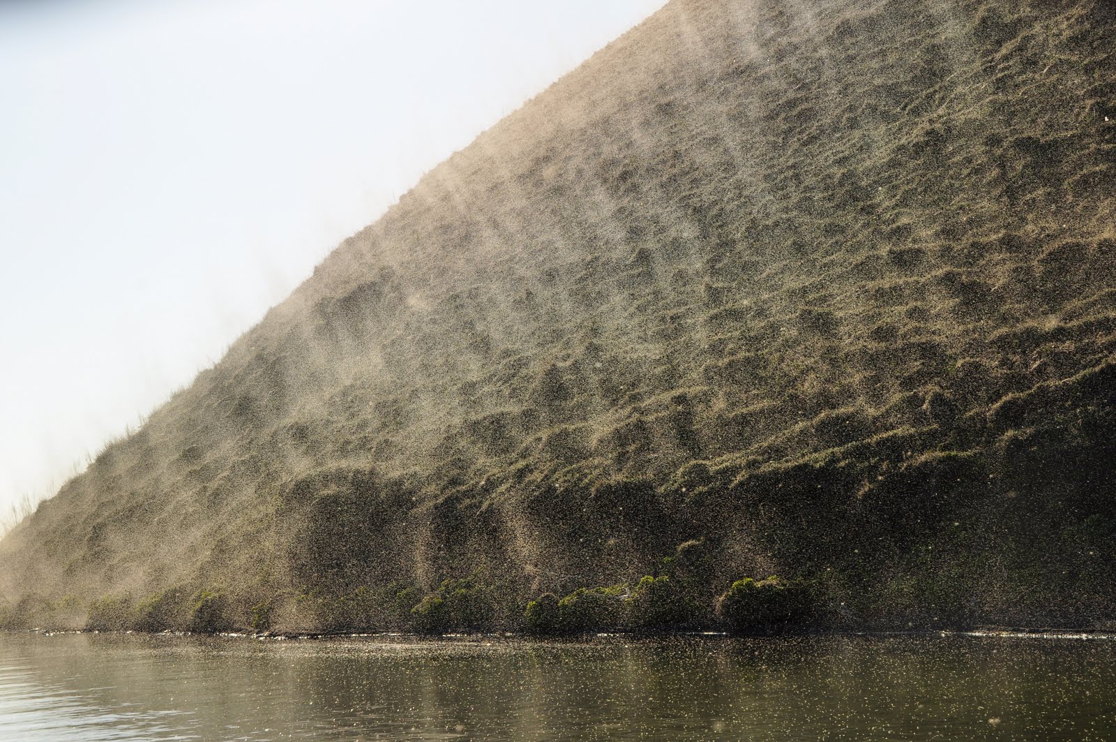
LOTS of mosquitoes:
(Credit: University of Winsconsin - Madison)
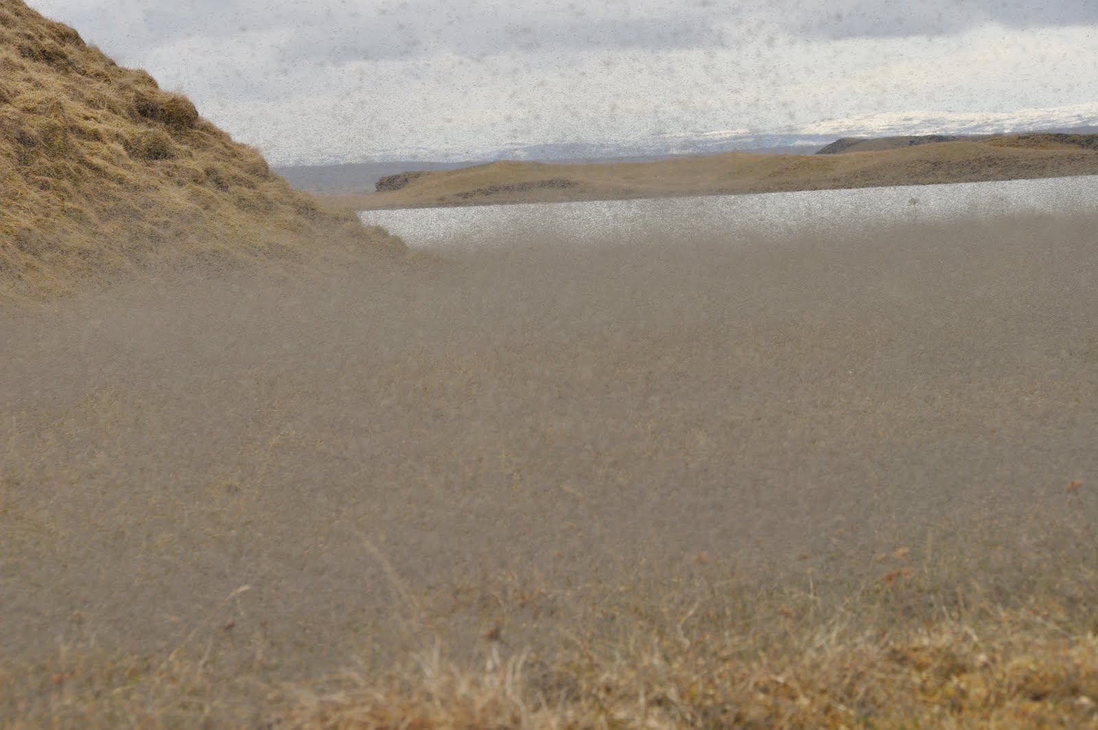
Seriously, I'm NOT kidding here:
(Credit: University of Wisconsin - Madison)
These nurture a tremendous food chain culminating in the lake's bird life, including rare species. The plant life is rarer still.
But let's back off all that for a second, because, you see, I lied. Icelandic "mosquitoes" are not terrifying. These are Tanytarsus gracilentus, a non-biting species; they're peaceful filter feeders. But there is one thing terrifying that is stalking that ecosystem: Pollution. And the last thing they need is more.
Bárðarbunga, I'm looking in your general direction. :Þ
Join us below the fold on Eldfjallavakt.

(Credit: Chris Zielecki)
Mývatn is one of my favorite places, dotted with hundreds of pseudocraters (a rare phenomenon) left from the last lava flow from neighboring Hverfjall:
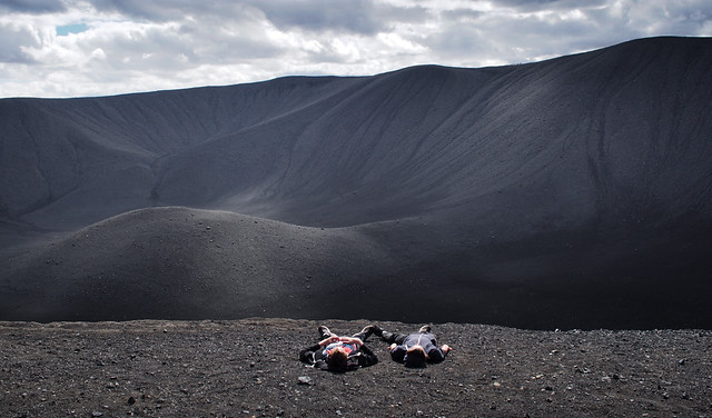
(Credit: Gunnar Salvarsson)
Warm lava cave springs so clear you can hardly see where the water begins lie in ravines on its eastern shore:
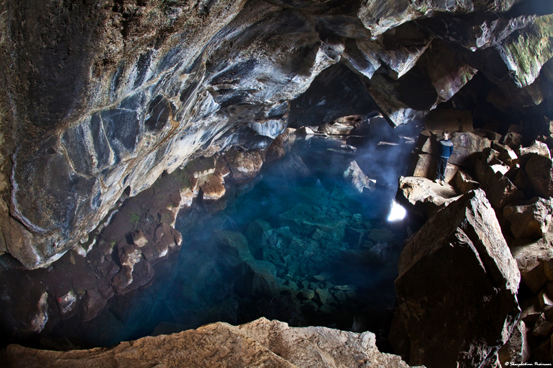
(Credit: Skarpi.is)
And not far away are a diversity of natural treasures, such as the lava fields of Dimmuborgir, ice-rock cave Lofthellir, and various geothermal features beside Hverfjall:
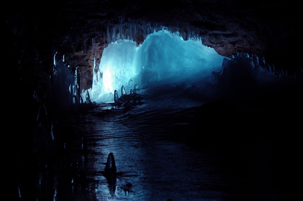
(Credit: Saga Travel)
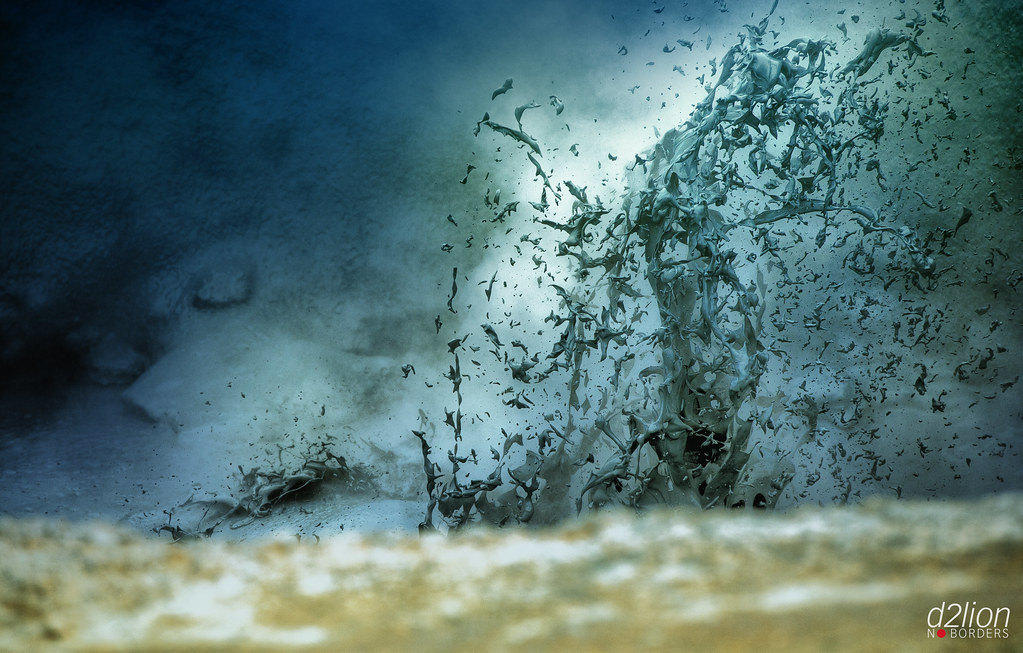
(Credit: David Delion)

(Credit: Marie Laure Even)
But it's the rich biological life that is most special, including more ducks than you could count. No, not vulnerable species like the Long-Tailed Duck:
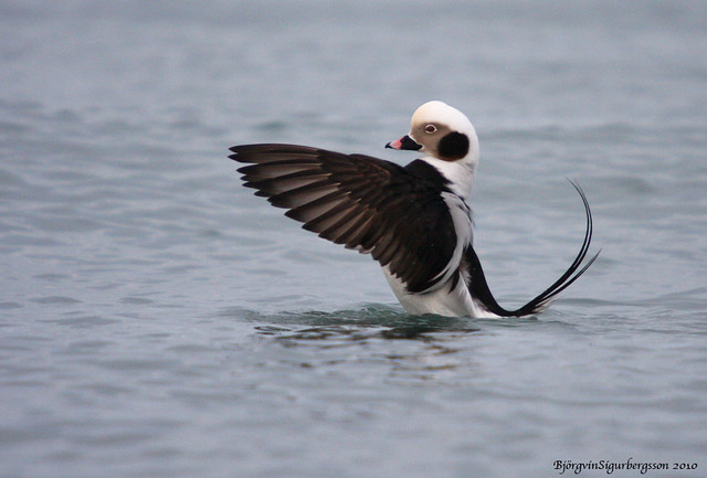
(Credit: Björgvín Sigurbergsson)
... but a lifeform much more humble: the marimo.
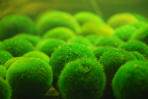
(Credit: Yu Chung Lin)
Known in Icelandic by the unflattering name of Kúluskítur ("shitballs"), they're fuzzy, dense green balls of a simple, normally free-floating algae (Aegagropila linnaei) that becomes coaxed into growing in balls by the particular conditions in only a few lakes in the world, such as Lake Akan in Hokkaido and Mývatn, Iceland.
Or at least, formerly Mývatn.
The marimo have been the canary in the coal mine toward the health of the Mývatn system, and their disappearance due to the increase in nutrient runoff from manure and septic tanks. There's a lot of concern that the Mývatn ecosystem as a whole could face a serious ecological threat.
So what's the last thing it could use right about now? How about a big cloud of toxic gas?
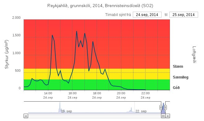
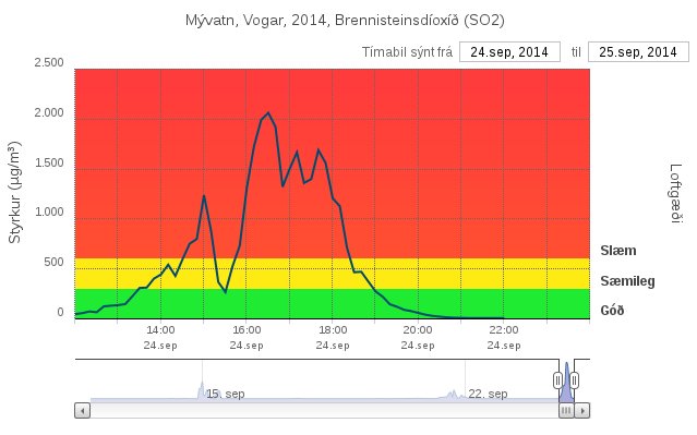
Mývatn has been being targeted every several days now, so I suppose this isn't any radical new news. But with peaks over 2000 µg/m³ at the lake and 1600 µg/m³ at a nearby elementary school, and high levels for hours at a time, it's not only people that will be feeling the effects of the pollution surges.
A duck can't shut itself in its house, close the windows, and wait for the pollution to pass.
But enough with air. It's time for lava news.
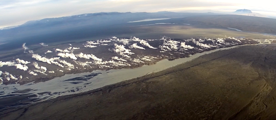
I've mentioned before that the eruption on Holuhraun is redrawing the map. Well, now it's not just trying for topo maps, but road maps as well. The flow is about 200 meters from taking out the road Gæsavatnaleið.
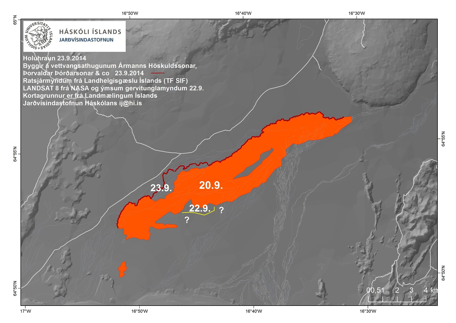
Of the new lava flows, the southern tongue continues at the same pace as yesterday. The northern tongue is moving faster than yesterday. It will be interesting to watch them both. The southern flow is destined to run into the deepening water of the "lake" in the river. The northern flow will run into a ridge that previously redirected the first flow toward Vaðalda. Whether the north flow will flow over the ridge or over the previous flow, I have no clue.
I figured people could use a sense of scale for the lava... so I made one. What would it look like if you stacked the entire lava flow into a big cube? Click for a larger view.
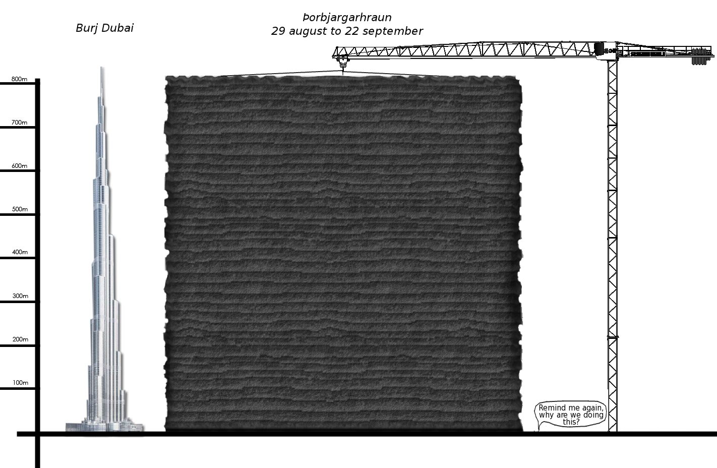
This is no little eruption! The people down there in the picture are to scale. What people? Look really, really closely, they're only two pixels tall.
Since I'm a big fan of graphics to help give people a sense of scale, I made one for Bárðarbunga's subsidence as well:
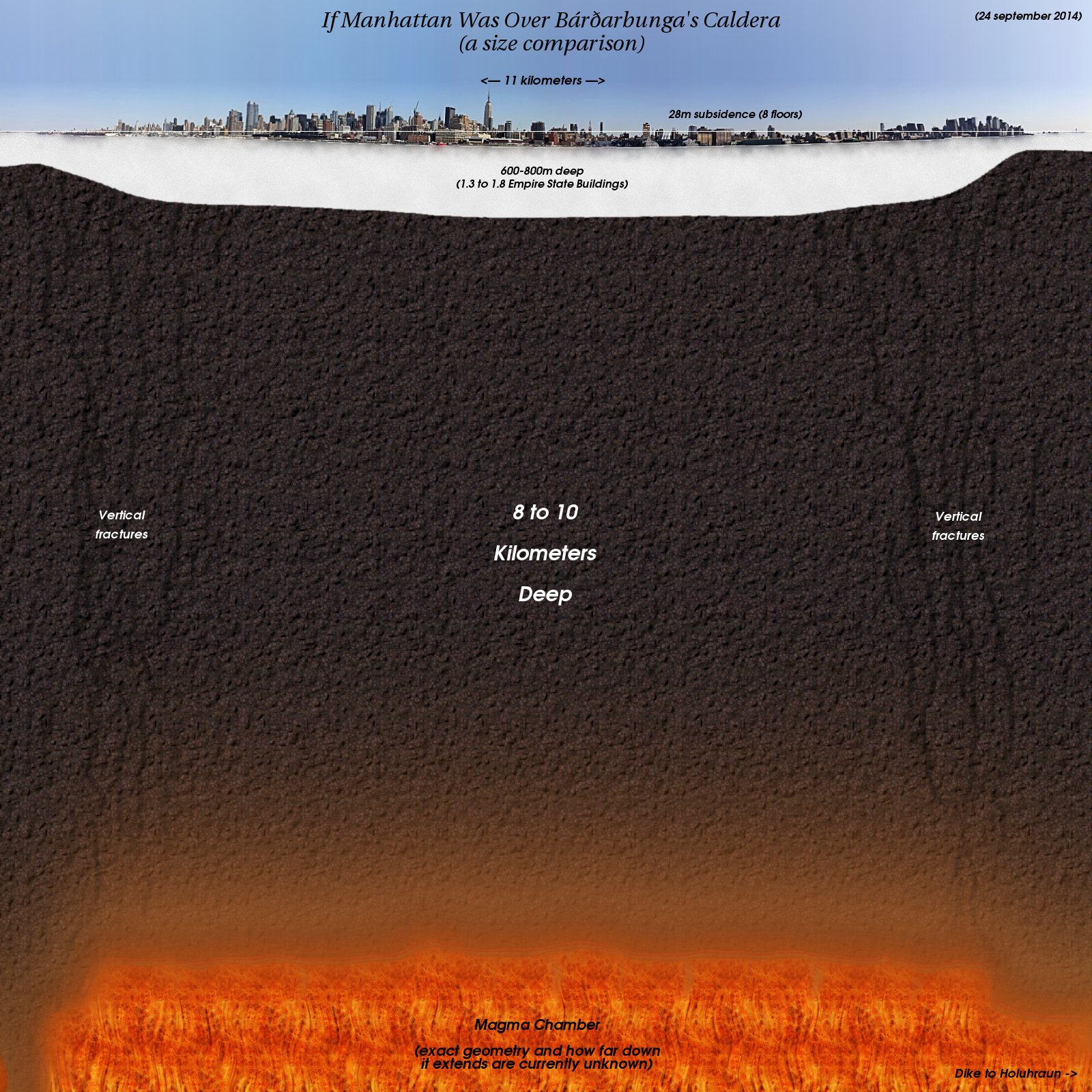
I had the challenge of perspective, in that some buildings are closer to the camera than others. So I chose to use the buildings closest to the camera for scaling the surface subsidence, but the overall dimensions for everything else.
Now, for just a couple pictures of the photographic variety:
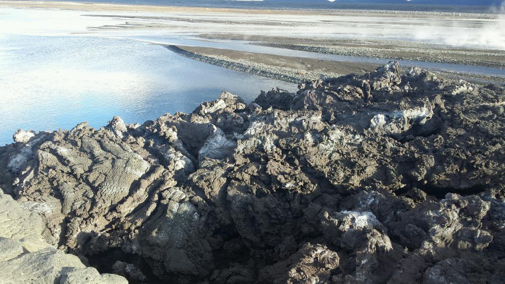
(Credit: Gísli Einarsson)
(Credit: Jara Fatíma Brynjólfsdóttir)
And, lastly...
It's less than an hour until our Daily Kos Styrktarátak Slysavarnarfélagsins Landsbjargar, our drive to raise money for ICESAR (Icelandic Search and Rescue), expires. We'll be announcing our Icelandic care package winners, both for the largest individual donor (currently standing at $300) and for the raffle-drawn prize (I'll probably do the latter in two stages, semifinalists, then a winner).
If you haven't yet had a chance to donate, drop on in, and if you could, drop me a line either in the comments, a private message, or at meme05@eaku.net so I can register the donation. :) Also, as per tradition, adding $0.01 at the end of the donation helps earmark it as part of this fundraising drive.
Our running total is $8049. Come on, people, last chance! Again, I'll update with the tallies and the prize winners when I get the final numbers tomorrow :)
